You are here: Home > Network List > TA - USArray Transportable Network (new EarthScope stations) Stations List
> Station F26K Sheenjek River, AK, USA > Earthquake Result Viewer
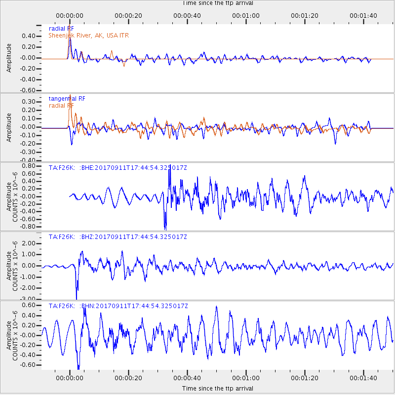
F26K Sheenjek River, AK, USA - Earthquake Result Viewer
*The percent match for this event was below the threshold and hence no stack was calculated.
| Earthquake location: |
Volcano Islands, Japan Region |
| Earthquake latitude/longitude: |
24.0/142.3 |
| Earthquake time(UTC): |
2017/09/11 (254) 17:35:09 GMT |
| Earthquake Depth: |
35 km |
| Earthquake Magnitude: |
5.7 Mww |
| Earthquake Catalog/Contributor: |
NEIC PDE/us |
|
| Network: |
TA USArray Transportable Network (new EarthScope stations) |
| Station: |
F26K Sheenjek River, AK, USA |
| Lat/Lon: |
67.69 N/144.15 W |
| Elevation: |
683 m |
|
| Distance: |
61.8 deg |
| Az: |
24.536 deg |
| Baz: |
264.413 deg |
| Ray Param: |
$rayparam |
*The percent match for this event was below the threshold and hence was not used in the summary stack. |
|
| Radial Match: |
71.78882 % |
| Radial Bump: |
400 |
| Transverse Match: |
75.45602 % |
| Transverse Bump: |
400 |
| SOD ConfigId: |
13570011 |
| Insert Time: |
2019-04-28 18:38:06.541 +0000 |
| GWidth: |
2.5 |
| Max Bumps: |
400 |
| Tol: |
0.001 |
|
Signal To Noise
| Channel | StoN | STA | LTA |
| TA:F26K: :BHZ:20170911T17:44:54.325017Z | 8.05505 | 9.754108E-7 | 1.2109308E-7 |
| TA:F26K: :BHN:20170911T17:44:54.325017Z | 2.7080002 | 3.172292E-7 | 1.17145184E-7 |
| TA:F26K: :BHE:20170911T17:44:54.325017Z | 3.1917598 | 3.5789634E-7 | 1.1213135E-7 |
| Arrivals |
| Ps | |
| PpPs | |
| PsPs/PpSs | |


