You are here: Home > Network List > TA - USArray Transportable Network (new EarthScope stations) Stations List
> Station G31M Satah River, YT, CAN > Earthquake Result Viewer
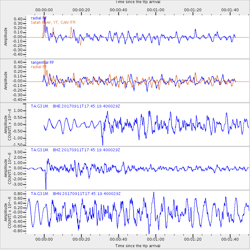
G31M Satah River, YT, CAN - Earthquake Result Viewer
*The percent match for this event was below the threshold and hence no stack was calculated.
| Earthquake location: |
Volcano Islands, Japan Region |
| Earthquake latitude/longitude: |
24.0/142.3 |
| Earthquake time(UTC): |
2017/09/11 (254) 17:35:09 GMT |
| Earthquake Depth: |
35 km |
| Earthquake Magnitude: |
5.7 Mww |
| Earthquake Catalog/Contributor: |
NEIC PDE/us |
|
| Network: |
TA USArray Transportable Network (new EarthScope stations) |
| Station: |
G31M Satah River, YT, CAN |
| Lat/Lon: |
66.92 N/134.27 W |
| Elevation: |
61 m |
|
| Distance: |
65.6 deg |
| Az: |
25.459 deg |
| Baz: |
273.927 deg |
| Ray Param: |
$rayparam |
*The percent match for this event was below the threshold and hence was not used in the summary stack. |
|
| Radial Match: |
64.06861 % |
| Radial Bump: |
400 |
| Transverse Match: |
56.655815 % |
| Transverse Bump: |
400 |
| SOD ConfigId: |
13570011 |
| Insert Time: |
2019-04-28 18:38:20.913 +0000 |
| GWidth: |
2.5 |
| Max Bumps: |
400 |
| Tol: |
0.001 |
|
Signal To Noise
| Channel | StoN | STA | LTA |
| TA:G31M: :BHZ:20170911T17:45:19.400029Z | 3.9195707 | 1.1216765E-6 | 2.861733E-7 |
| TA:G31M: :BHN:20170911T17:45:19.400029Z | 0.90984833 | 3.34876E-7 | 3.6805696E-7 |
| TA:G31M: :BHE:20170911T17:45:19.400029Z | 2.1629415 | 5.616374E-7 | 2.5966372E-7 |
| Arrivals |
| Ps | |
| PpPs | |
| PsPs/PpSs | |


