You are here: Home > Network List > TA - USArray Transportable Network (new EarthScope stations) Stations List
> Station I30M Mount Dempster, Yukon, CAN > Earthquake Result Viewer
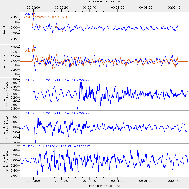
I30M Mount Dempster, Yukon, CAN - Earthquake Result Viewer
*The percent match for this event was below the threshold and hence no stack was calculated.
| Earthquake location: |
Volcano Islands, Japan Region |
| Earthquake latitude/longitude: |
24.0/142.3 |
| Earthquake time(UTC): |
2017/09/11 (254) 17:35:09 GMT |
| Earthquake Depth: |
35 km |
| Earthquake Magnitude: |
5.7 Mww |
| Earthquake Catalog/Contributor: |
NEIC PDE/us |
|
| Network: |
TA USArray Transportable Network (new EarthScope stations) |
| Station: |
I30M Mount Dempster, Yukon, CAN |
| Lat/Lon: |
65.22 N/136.38 W |
| Elevation: |
1399 m |
|
| Distance: |
64.9 deg |
| Az: |
27.392 deg |
| Baz: |
272.813 deg |
| Ray Param: |
$rayparam |
*The percent match for this event was below the threshold and hence was not used in the summary stack. |
|
| Radial Match: |
70.21662 % |
| Radial Bump: |
400 |
| Transverse Match: |
72.737175 % |
| Transverse Bump: |
400 |
| SOD ConfigId: |
13570011 |
| Insert Time: |
2019-04-28 18:38:37.437 +0000 |
| GWidth: |
2.5 |
| Max Bumps: |
400 |
| Tol: |
0.001 |
|
Signal To Noise
| Channel | StoN | STA | LTA |
| TA:I30M: :BHZ:20170911T17:45:14.525029Z | 3.3741496 | 6.4035527E-7 | 1.8978271E-7 |
| TA:I30M: :BHN:20170911T17:45:14.525029Z | 1.6166914 | 1.7217099E-7 | 1.0649589E-7 |
| TA:I30M: :BHE:20170911T17:45:14.525029Z | 1.8638058 | 3.8961068E-7 | 2.0904038E-7 |
| Arrivals |
| Ps | |
| PpPs | |
| PsPs/PpSs | |


