You are here: Home > Network List > TA - USArray Transportable Network (new EarthScope stations) Stations List
> Station I22A 9 Mile Ranch, Kaycee, WY, USA > Earthquake Result Viewer
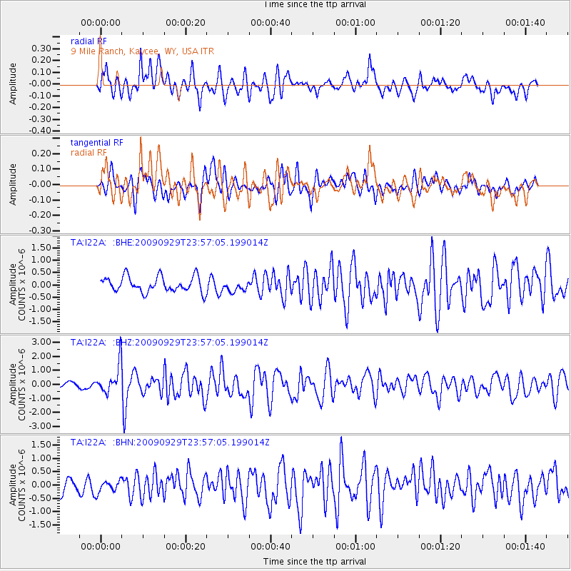
I22A 9 Mile Ranch, Kaycee, WY, USA - Earthquake Result Viewer
*The percent match for this event was below the threshold and hence no stack was calculated.
| Earthquake location: |
Samoa Islands Region |
| Earthquake latitude/longitude: |
-15.8/-172.6 |
| Earthquake time(UTC): |
2009/09/29 (272) 23:45:03 GMT |
| Earthquake Depth: |
10 km |
| Earthquake Magnitude: |
6.0 MB, 5.8 MS |
| Earthquake Catalog/Contributor: |
WHDF/NEIC |
|
| Network: |
TA USArray Transportable Network (new EarthScope stations) |
| Station: |
I22A 9 Mile Ranch, Kaycee, WY, USA |
| Lat/Lon: |
43.89 N/106.48 W |
| Elevation: |
1430 m |
|
| Distance: |
84.5 deg |
| Az: |
41.591 deg |
| Baz: |
242.102 deg |
| Ray Param: |
$rayparam |
*The percent match for this event was below the threshold and hence was not used in the summary stack. |
|
| Radial Match: |
66.70667 % |
| Radial Bump: |
400 |
| Transverse Match: |
59.934986 % |
| Transverse Bump: |
376 |
| SOD ConfigId: |
2622 |
| Insert Time: |
2010-03-06 03:38:20.413 +0000 |
| GWidth: |
2.5 |
| Max Bumps: |
400 |
| Tol: |
0.001 |
|
Signal To Noise
| Channel | StoN | STA | LTA |
| TA:I22A: :BHZ:20090929T23:57:05.199014Z | 4.9894443 | 1.087525E-6 | 2.1796515E-7 |
| TA:I22A: :BHN:20090929T23:57:05.199014Z | 0.6985593 | 2.0032651E-7 | 2.8677096E-7 |
| TA:I22A: :BHE:20090929T23:57:05.199014Z | 0.7071661 | 2.1988198E-7 | 3.10934E-7 |
| Arrivals |
| Ps | |
| PpPs | |
| PsPs/PpSs | |


