You are here: Home > Network List > TA - USArray Transportable Network (new EarthScope stations) Stations List
> Station M31M Drury Creek, Yukon, CA > Earthquake Result Viewer
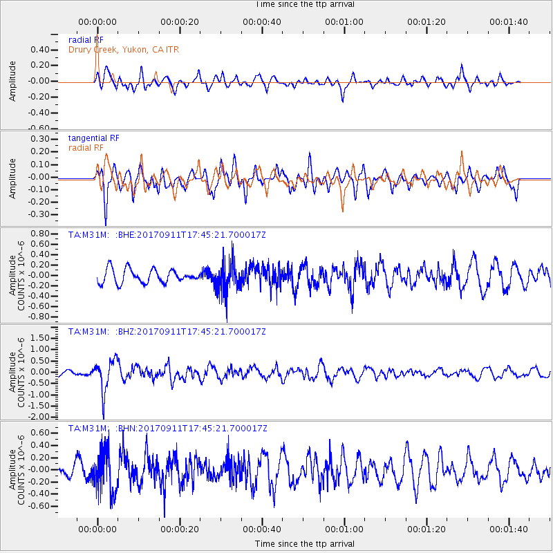
M31M Drury Creek, Yukon, CA - Earthquake Result Viewer
*The percent match for this event was below the threshold and hence no stack was calculated.
| Earthquake location: |
Volcano Islands, Japan Region |
| Earthquake latitude/longitude: |
24.0/142.3 |
| Earthquake time(UTC): |
2017/09/11 (254) 17:35:09 GMT |
| Earthquake Depth: |
35 km |
| Earthquake Magnitude: |
5.7 Mww |
| Earthquake Catalog/Contributor: |
NEIC PDE/us |
|
| Network: |
TA USArray Transportable Network (new EarthScope stations) |
| Station: |
M31M Drury Creek, Yukon, CA |
| Lat/Lon: |
62.20 N/134.39 W |
| Elevation: |
639 m |
|
| Distance: |
66.0 deg |
| Az: |
30.641 deg |
| Baz: |
275.943 deg |
| Ray Param: |
$rayparam |
*The percent match for this event was below the threshold and hence was not used in the summary stack. |
|
| Radial Match: |
65.42957 % |
| Radial Bump: |
400 |
| Transverse Match: |
70.7338 % |
| Transverse Bump: |
400 |
| SOD ConfigId: |
13570011 |
| Insert Time: |
2019-04-28 18:39:10.239 +0000 |
| GWidth: |
2.5 |
| Max Bumps: |
400 |
| Tol: |
0.001 |
|
Signal To Noise
| Channel | StoN | STA | LTA |
| TA:M31M: :BHZ:20170911T17:45:21.700017Z | 5.4367223 | 6.96946E-7 | 1.2819233E-7 |
| TA:M31M: :BHN:20170911T17:45:21.700017Z | 3.2378402 | 3.413614E-7 | 1.0542874E-7 |
| TA:M31M: :BHE:20170911T17:45:21.700017Z | 2.2237065 | 2.9392126E-7 | 1.3217628E-7 |
| Arrivals |
| Ps | |
| PpPs | |
| PsPs/PpSs | |


