You are here: Home > Network List > TA - USArray Transportable Network (new EarthScope stations) Stations List
> Station I22A 9 Mile Ranch, Kaycee, WY, USA > Earthquake Result Viewer
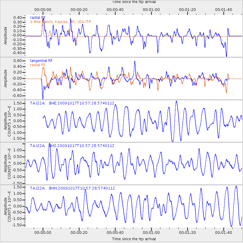
I22A 9 Mile Ranch, Kaycee, WY, USA - Earthquake Result Viewer
*The percent match for this event was below the threshold and hence no stack was calculated.
| Earthquake location: |
Samoa Islands Region |
| Earthquake latitude/longitude: |
-16.4/-172.0 |
| Earthquake time(UTC): |
2009/10/17 (290) 10:45:26 GMT |
| Earthquake Depth: |
10 km |
| Earthquake Magnitude: |
5.7 MB, 5.3 MS, 5.7 MW, 5.7 MW |
| Earthquake Catalog/Contributor: |
WHDF/NEIC |
|
| Network: |
TA USArray Transportable Network (new EarthScope stations) |
| Station: |
I22A 9 Mile Ranch, Kaycee, WY, USA |
| Lat/Lon: |
43.89 N/106.48 W |
| Elevation: |
1430 m |
|
| Distance: |
84.6 deg |
| Az: |
41.363 deg |
| Baz: |
241.341 deg |
| Ray Param: |
$rayparam |
*The percent match for this event was below the threshold and hence was not used in the summary stack. |
|
| Radial Match: |
59.254192 % |
| Radial Bump: |
400 |
| Transverse Match: |
47.990067 % |
| Transverse Bump: |
400 |
| SOD ConfigId: |
2622 |
| Insert Time: |
2010-03-06 03:38:28.095 +0000 |
| GWidth: |
2.5 |
| Max Bumps: |
400 |
| Tol: |
0.001 |
|
Signal To Noise
| Channel | StoN | STA | LTA |
| TA:I22A: :BHZ:20091017T10:57:28.574011Z | 2.017287 | 7.837017E-7 | 3.884929E-7 |
| TA:I22A: :BHN:20091017T10:57:28.574011Z | 0.45763427 | 2.4830294E-7 | 5.4257947E-7 |
| TA:I22A: :BHE:20091017T10:57:28.574011Z | 1.3560356 | 6.2168135E-7 | 4.5845505E-7 |
| Arrivals |
| Ps | |
| PpPs | |
| PsPs/PpSs | |


