You are here: Home > Network List > TA - USArray Transportable Network (new EarthScope stations) Stations List
> Station I22A 9 Mile Ranch, Kaycee, WY, USA > Earthquake Result Viewer
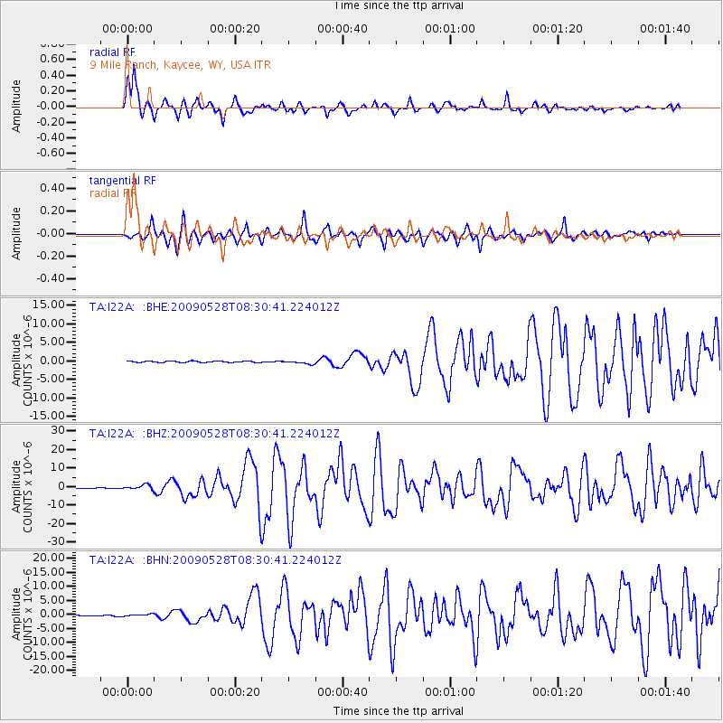
I22A 9 Mile Ranch, Kaycee, WY, USA - Earthquake Result Viewer
*The percent match for this event was below the threshold and hence no stack was calculated.
| Earthquake location: |
North Of Honduras |
| Earthquake latitude/longitude: |
16.7/-86.2 |
| Earthquake time(UTC): |
2009/05/28 (148) 08:24:45 GMT |
| Earthquake Depth: |
10 km |
| Earthquake Magnitude: |
6.7 MB, 7.2 MS, 7.3 MW, 7.3 MW |
| Earthquake Catalog/Contributor: |
WHDF/NEIC |
|
| Network: |
TA USArray Transportable Network (new EarthScope stations) |
| Station: |
I22A 9 Mile Ranch, Kaycee, WY, USA |
| Lat/Lon: |
43.89 N/106.48 W |
| Elevation: |
1430 m |
|
| Distance: |
32.1 deg |
| Az: |
331.872 deg |
| Baz: |
141.327 deg |
| Ray Param: |
$rayparam |
*The percent match for this event was below the threshold and hence was not used in the summary stack. |
|
| Radial Match: |
91.692764 % |
| Radial Bump: |
354 |
| Transverse Match: |
76.83145 % |
| Transverse Bump: |
375 |
| SOD ConfigId: |
2648 |
| Insert Time: |
2010-03-06 03:38:32.760 +0000 |
| GWidth: |
2.5 |
| Max Bumps: |
400 |
| Tol: |
0.001 |
|
Signal To Noise
| Channel | StoN | STA | LTA |
| TA:I22A: :BHZ:20090528T08:30:41.224012Z | 11.470109 | 1.2885836E-6 | 1.1234275E-7 |
| TA:I22A: :BHN:20090528T08:30:41.224012Z | 1.7789216 | 4.12974E-7 | 2.3214851E-7 |
| TA:I22A: :BHE:20090528T08:30:41.224012Z | 2.4629488 | 4.4078968E-7 | 1.7896826E-7 |
| Arrivals |
| Ps | |
| PpPs | |
| PsPs/PpSs | |


