You are here: Home > Network List > US - United States National Seismic Network Stations List
> Station WUAZ Wupatki, Arizona, USA > Earthquake Result Viewer
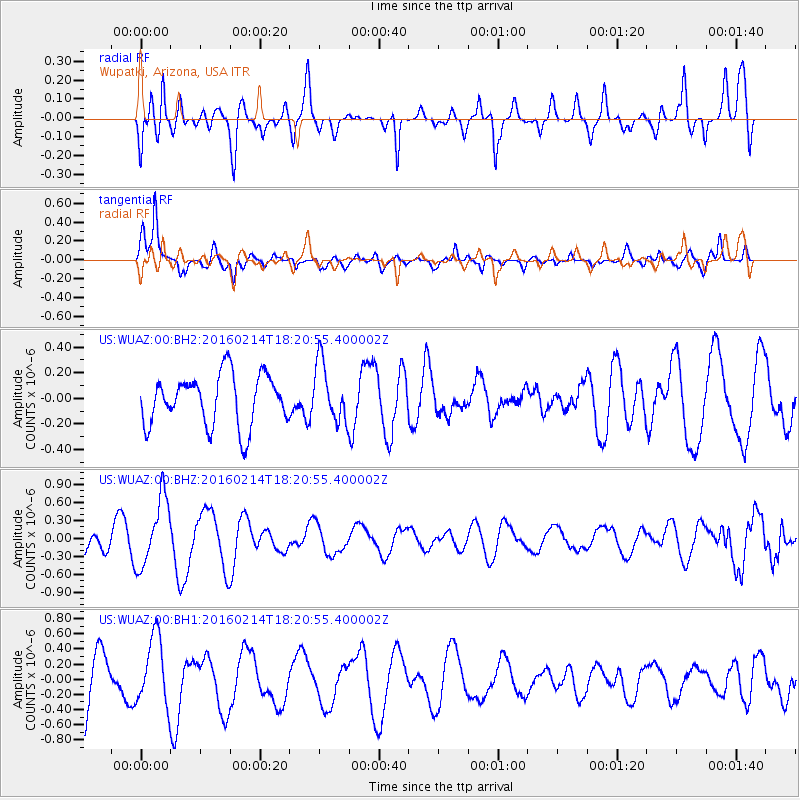
WUAZ Wupatki, Arizona, USA - Earthquake Result Viewer
*The percent match for this event was below the threshold and hence no stack was calculated.
| Earthquake location: |
Southeast Of Honshu, Japan |
| Earthquake latitude/longitude: |
30.3/138.9 |
| Earthquake time(UTC): |
2016/02/14 (045) 18:09:26 GMT |
| Earthquake Depth: |
413 km |
| Earthquake Magnitude: |
5.7 MB |
| Earthquake Catalog/Contributor: |
NEIC PDE/NEIC COMCAT |
|
| Network: |
US United States National Seismic Network |
| Station: |
WUAZ Wupatki, Arizona, USA |
| Lat/Lon: |
35.52 N/111.37 W |
| Elevation: |
1592 m |
|
| Distance: |
87.0 deg |
| Az: |
50.237 deg |
| Baz: |
305.419 deg |
| Ray Param: |
$rayparam |
*The percent match for this event was below the threshold and hence was not used in the summary stack. |
|
| Radial Match: |
61.908154 % |
| Radial Bump: |
400 |
| Transverse Match: |
82.50429 % |
| Transverse Bump: |
400 |
| SOD ConfigId: |
1427151 |
| Insert Time: |
2016-02-28 19:01:44.372 +0000 |
| GWidth: |
2.5 |
| Max Bumps: |
400 |
| Tol: |
0.001 |
|
Signal To Noise
| Channel | StoN | STA | LTA |
| US:WUAZ:00:BHZ:20160214T18:20:55.400002Z | 1.8619651 | 5.681139E-7 | 3.051152E-7 |
| US:WUAZ:00:BH1:20160214T18:20:55.400002Z | 1.1989576 | 4.5029975E-7 | 3.7557604E-7 |
| US:WUAZ:00:BH2:20160214T18:20:55.400002Z | 1.1617314 | 2.3137903E-7 | 1.991674E-7 |
| Arrivals |
| Ps | |
| PpPs | |
| PsPs/PpSs | |


