You are here: Home > Network List > UW - Pacific Northwest Regional Seismic Network Stations List
> Station FISH Seaside, OR, USA > Earthquake Result Viewer
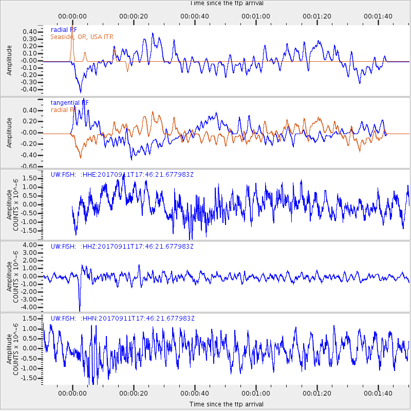
FISH Seaside, OR, USA - Earthquake Result Viewer
*The percent match for this event was below the threshold and hence no stack was calculated.
| Earthquake location: |
Volcano Islands, Japan Region |
| Earthquake latitude/longitude: |
24.0/142.3 |
| Earthquake time(UTC): |
2017/09/11 (254) 17:35:09 GMT |
| Earthquake Depth: |
35 km |
| Earthquake Magnitude: |
5.7 Mww |
| Earthquake Catalog/Contributor: |
NEIC PDE/us |
|
| Network: |
UW Pacific Northwest Regional Seismic Network |
| Station: |
FISH Seaside, OR, USA |
| Lat/Lon: |
45.93 N/123.56 W |
| Elevation: |
325 m |
|
| Distance: |
75.9 deg |
| Az: |
45.868 deg |
| Baz: |
289.807 deg |
| Ray Param: |
$rayparam |
*The percent match for this event was below the threshold and hence was not used in the summary stack. |
|
| Radial Match: |
51.847958 % |
| Radial Bump: |
400 |
| Transverse Match: |
37.319862 % |
| Transverse Bump: |
400 |
| SOD ConfigId: |
13570011 |
| Insert Time: |
2019-04-28 18:40:26.551 +0000 |
| GWidth: |
2.5 |
| Max Bumps: |
400 |
| Tol: |
0.001 |
|
Signal To Noise
| Channel | StoN | STA | LTA |
| UW:FISH: :HHZ:20170911T17:46:21.677983Z | 4.8500404 | 1.2916752E-6 | 2.6632256E-7 |
| UW:FISH: :HHN:20170911T17:46:21.677983Z | 0.88635445 | 5.939997E-7 | 6.701604E-7 |
| UW:FISH: :HHE:20170911T17:46:21.677983Z | 1.2155505 | 8.051616E-7 | 6.623843E-7 |
| Arrivals |
| Ps | |
| PpPs | |
| PsPs/PpSs | |


