You are here: Home > Network List > UW - Pacific Northwest Regional Seismic Network Stations List
> Station UMAT Pilot Rock, OR, USA > Earthquake Result Viewer
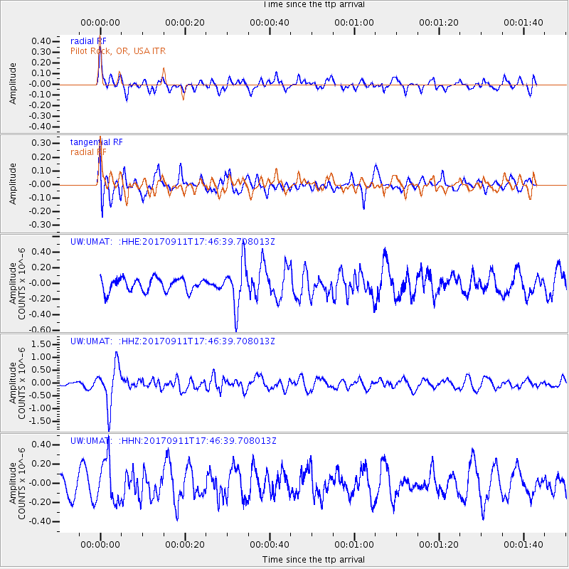
UMAT Pilot Rock, OR, USA - Earthquake Result Viewer
*The percent match for this event was below the threshold and hence no stack was calculated.
| Earthquake location: |
Volcano Islands, Japan Region |
| Earthquake latitude/longitude: |
24.0/142.3 |
| Earthquake time(UTC): |
2017/09/11 (254) 17:35:09 GMT |
| Earthquake Depth: |
35 km |
| Earthquake Magnitude: |
5.7 Mww |
| Earthquake Catalog/Contributor: |
NEIC PDE/us |
|
| Network: |
UW Pacific Northwest Regional Seismic Network |
| Station: |
UMAT Pilot Rock, OR, USA |
| Lat/Lon: |
45.29 N/118.96 W |
| Elevation: |
1318 m |
|
| Distance: |
79.2 deg |
| Az: |
45.273 deg |
| Baz: |
292.955 deg |
| Ray Param: |
$rayparam |
*The percent match for this event was below the threshold and hence was not used in the summary stack. |
|
| Radial Match: |
63.48787 % |
| Radial Bump: |
400 |
| Transverse Match: |
68.3914 % |
| Transverse Bump: |
400 |
| SOD ConfigId: |
13570011 |
| Insert Time: |
2019-04-28 18:40:43.391 +0000 |
| GWidth: |
2.5 |
| Max Bumps: |
400 |
| Tol: |
0.001 |
|
Signal To Noise
| Channel | StoN | STA | LTA |
| UW:UMAT: :HHZ:20170911T17:46:39.708013Z | 5.8921795 | 7.9479514E-7 | 1.3488983E-7 |
| UW:UMAT: :HHN:20170911T17:46:39.708013Z | 2.2769861 | 2.2266862E-7 | 9.779094E-8 |
| UW:UMAT: :HHE:20170911T17:46:39.708013Z | 3.427963 | 2.830995E-7 | 8.2585345E-8 |
| Arrivals |
| Ps | |
| PpPs | |
| PsPs/PpSs | |


