You are here: Home > Network List > IU - Global Seismograph Network (GSN - IRIS/USGS) Stations List
> Station PMG Port Moresby, New Guinea > Earthquake Result Viewer
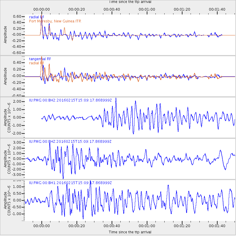
PMG Port Moresby, New Guinea - Earthquake Result Viewer
*The percent match for this event was below the threshold and hence no stack was calculated.
| Earthquake location: |
Tonga Islands |
| Earthquake latitude/longitude: |
-21.0/-175.5 |
| Earthquake time(UTC): |
2016/02/15 (046) 15:02:33 GMT |
| Earthquake Depth: |
10 km |
| Earthquake Magnitude: |
5.7 MB |
| Earthquake Catalog/Contributor: |
NEIC PDE/NEIC COMCAT |
|
| Network: |
IU Global Seismograph Network (GSN - IRIS/USGS) |
| Station: |
PMG Port Moresby, New Guinea |
| Lat/Lon: |
9.40 S/147.16 E |
| Elevation: |
90 m |
|
| Distance: |
37.7 deg |
| Az: |
282.076 deg |
| Baz: |
112.189 deg |
| Ray Param: |
$rayparam |
*The percent match for this event was below the threshold and hence was not used in the summary stack. |
|
| Radial Match: |
88.71005 % |
| Radial Bump: |
400 |
| Transverse Match: |
88.80687 % |
| Transverse Bump: |
400 |
| SOD ConfigId: |
1427151 |
| Insert Time: |
2016-02-29 17:47:58.918 +0000 |
| GWidth: |
2.5 |
| Max Bumps: |
400 |
| Tol: |
0.001 |
|
Signal To Noise
| Channel | StoN | STA | LTA |
| IU:PMG:00:BHZ:20160215T15:09:17.868999Z | 5.0337524 | 9.404818E-7 | 1.8683514E-7 |
| IU:PMG:00:BH1:20160215T15:09:17.868999Z | 1.4662566 | 1.899245E-7 | 1.2953019E-7 |
| IU:PMG:00:BH2:20160215T15:09:17.868999Z | 1.9476597 | 3.269117E-7 | 1.6784848E-7 |
| Arrivals |
| Ps | |
| PpPs | |
| PsPs/PpSs | |


