You are here: Home > Network List > IU - Global Seismograph Network (GSN - IRIS/USGS) Stations List
> Station RSSD Black Hills, South Dakota, USA > Earthquake Result Viewer
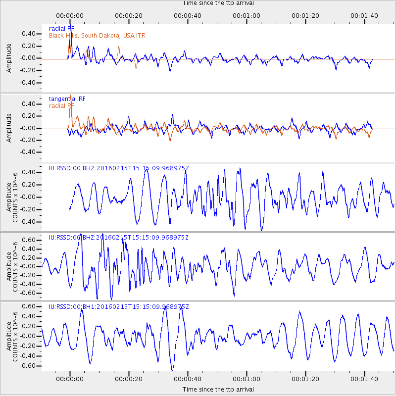
RSSD Black Hills, South Dakota, USA - Earthquake Result Viewer
*The percent match for this event was below the threshold and hence no stack was calculated.
| Earthquake location: |
Tonga Islands |
| Earthquake latitude/longitude: |
-21.0/-175.5 |
| Earthquake time(UTC): |
2016/02/15 (046) 15:02:33 GMT |
| Earthquake Depth: |
10 km |
| Earthquake Magnitude: |
5.7 MB |
| Earthquake Catalog/Contributor: |
NEIC PDE/NEIC COMCAT |
|
| Network: |
IU Global Seismograph Network (GSN - IRIS/USGS) |
| Station: |
RSSD Black Hills, South Dakota, USA |
| Lat/Lon: |
44.12 N/104.04 W |
| Elevation: |
2090 m |
|
| Distance: |
91.9 deg |
| Az: |
43.103 deg |
| Baz: |
242.434 deg |
| Ray Param: |
$rayparam |
*The percent match for this event was below the threshold and hence was not used in the summary stack. |
|
| Radial Match: |
66.790535 % |
| Radial Bump: |
400 |
| Transverse Match: |
45.53967 % |
| Transverse Bump: |
360 |
| SOD ConfigId: |
1427151 |
| Insert Time: |
2016-02-29 17:48:07.648 +0000 |
| GWidth: |
2.5 |
| Max Bumps: |
400 |
| Tol: |
0.001 |
|
Signal To Noise
| Channel | StoN | STA | LTA |
| IU:RSSD:00:BHZ:20160215T15:15:09.968975Z | 2.6335077 | 4.2325567E-7 | 1.6071937E-7 |
| IU:RSSD:00:BH1:20160215T15:15:09.968975Z | 1.9737673 | 2.8426592E-7 | 1.4402201E-7 |
| IU:RSSD:00:BH2:20160215T15:15:09.968975Z | 1.6064996 | 2.7307183E-7 | 1.6997939E-7 |
| Arrivals |
| Ps | |
| PpPs | |
| PsPs/PpSs | |


