You are here: Home > Network List > TA - USArray Transportable Network (new EarthScope stations) Stations List
> Station G31M Satah River, YT, CAN > Earthquake Result Viewer
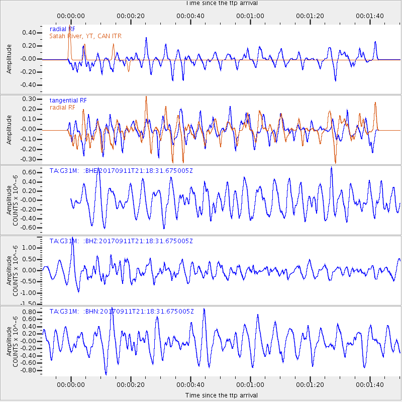
G31M Satah River, YT, CAN - Earthquake Result Viewer
*The percent match for this event was below the threshold and hence no stack was calculated.
| Earthquake location: |
Near Coast Of Chiapas, Mexico |
| Earthquake latitude/longitude: |
14.9/-93.9 |
| Earthquake time(UTC): |
2017/09/11 (254) 21:09:10 GMT |
| Earthquake Depth: |
27 km |
| Earthquake Magnitude: |
5.5 Mww |
| Earthquake Catalog/Contributor: |
NEIC PDE/us |
|
| Network: |
TA USArray Transportable Network (new EarthScope stations) |
| Station: |
G31M Satah River, YT, CAN |
| Lat/Lon: |
66.92 N/134.27 W |
| Elevation: |
61 m |
|
| Distance: |
58.3 deg |
| Az: |
342.559 deg |
| Baz: |
132.675 deg |
| Ray Param: |
$rayparam |
*The percent match for this event was below the threshold and hence was not used in the summary stack. |
|
| Radial Match: |
55.475273 % |
| Radial Bump: |
351 |
| Transverse Match: |
47.328712 % |
| Transverse Bump: |
395 |
| SOD ConfigId: |
13570011 |
| Insert Time: |
2019-04-28 18:46:55.023 +0000 |
| GWidth: |
2.5 |
| Max Bumps: |
400 |
| Tol: |
0.001 |
|
Signal To Noise
| Channel | StoN | STA | LTA |
| TA:G31M: :BHZ:20170911T21:18:31.675005Z | 4.3193207 | 6.209894E-7 | 1.4377017E-7 |
| TA:G31M: :BHN:20170911T21:18:31.675005Z | 0.5648888 | 1.5931256E-7 | 2.8202467E-7 |
| TA:G31M: :BHE:20170911T21:18:31.675005Z | 1.1213292 | 3.150407E-7 | 2.8095292E-7 |
| Arrivals |
| Ps | |
| PpPs | |
| PsPs/PpSs | |


