You are here: Home > Network List > TA - USArray Transportable Network (new EarthScope stations) Stations List
> Station I30M Mount Dempster, Yukon, CAN > Earthquake Result Viewer
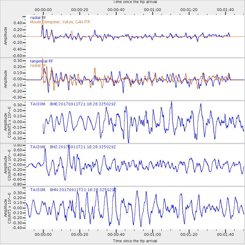
I30M Mount Dempster, Yukon, CAN - Earthquake Result Viewer
*The percent match for this event was below the threshold and hence no stack was calculated.
| Earthquake location: |
Near Coast Of Chiapas, Mexico |
| Earthquake latitude/longitude: |
14.9/-93.9 |
| Earthquake time(UTC): |
2017/09/11 (254) 21:09:10 GMT |
| Earthquake Depth: |
27 km |
| Earthquake Magnitude: |
5.5 Mww |
| Earthquake Catalog/Contributor: |
NEIC PDE/us |
|
| Network: |
TA USArray Transportable Network (new EarthScope stations) |
| Station: |
I30M Mount Dempster, Yukon, CAN |
| Lat/Lon: |
65.22 N/136.38 W |
| Elevation: |
1399 m |
|
| Distance: |
57.9 deg |
| Az: |
340.379 deg |
| Baz: |
129.6 deg |
| Ray Param: |
$rayparam |
*The percent match for this event was below the threshold and hence was not used in the summary stack. |
|
| Radial Match: |
63.850582 % |
| Radial Bump: |
400 |
| Transverse Match: |
55.09049 % |
| Transverse Bump: |
334 |
| SOD ConfigId: |
13570011 |
| Insert Time: |
2019-04-28 18:47:11.935 +0000 |
| GWidth: |
2.5 |
| Max Bumps: |
400 |
| Tol: |
0.001 |
|
Signal To Noise
| Channel | StoN | STA | LTA |
| TA:I30M: :BHZ:20170911T21:18:28.325029Z | 2.9928377 | 2.892047E-7 | 9.663227E-8 |
| TA:I30M: :BHN:20170911T21:18:28.325029Z | 0.5655481 | 8.7009525E-8 | 1.538499E-7 |
| TA:I30M: :BHE:20170911T21:18:28.325029Z | 1.707498 | 1.679317E-7 | 9.834958E-8 |
| Arrivals |
| Ps | |
| PpPs | |
| PsPs/PpSs | |


