You are here: Home > Network List > US - United States National Seismic Network Stations List
> Station WMOK Wichita Mountains, Oklahoma, USA > Earthquake Result Viewer
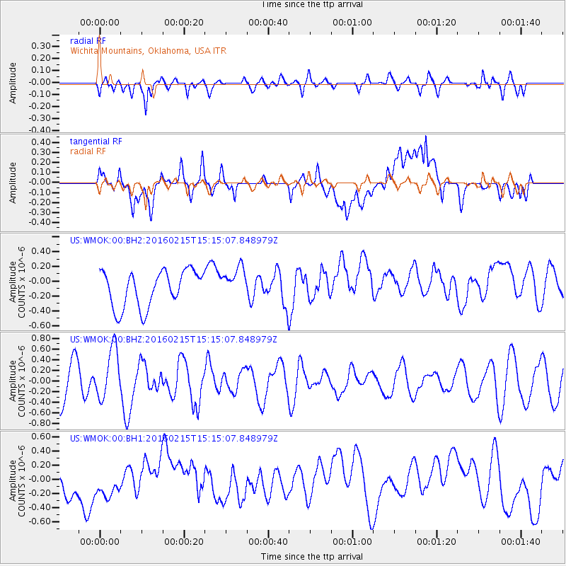
WMOK Wichita Mountains, Oklahoma, USA - Earthquake Result Viewer
*The percent match for this event was below the threshold and hence no stack was calculated.
| Earthquake location: |
Tonga Islands |
| Earthquake latitude/longitude: |
-21.0/-175.5 |
| Earthquake time(UTC): |
2016/02/15 (046) 15:02:33 GMT |
| Earthquake Depth: |
10 km |
| Earthquake Magnitude: |
5.7 MB |
| Earthquake Catalog/Contributor: |
NEIC PDE/NEIC COMCAT |
|
| Network: |
US United States National Seismic Network |
| Station: |
WMOK Wichita Mountains, Oklahoma, USA |
| Lat/Lon: |
34.74 N/98.78 W |
| Elevation: |
486 m |
|
| Distance: |
91.5 deg |
| Az: |
53.308 deg |
| Baz: |
245.468 deg |
| Ray Param: |
$rayparam |
*The percent match for this event was below the threshold and hence was not used in the summary stack. |
|
| Radial Match: |
59.045654 % |
| Radial Bump: |
400 |
| Transverse Match: |
42.495464 % |
| Transverse Bump: |
400 |
| SOD ConfigId: |
1427151 |
| Insert Time: |
2016-02-29 17:50:56.556 +0000 |
| GWidth: |
2.5 |
| Max Bumps: |
400 |
| Tol: |
0.001 |
|
Signal To Noise
| Channel | StoN | STA | LTA |
| US:WMOK:00:BHZ:20160215T15:15:07.848979Z | 1.4061835 | 4.7765514E-7 | 3.3968197E-7 |
| US:WMOK:00:BH1:20160215T15:15:07.848979Z | 0.884661 | 3.437544E-7 | 3.885719E-7 |
| US:WMOK:00:BH2:20160215T15:15:07.848979Z | 0.893336 | 2.1791891E-7 | 2.4393836E-7 |
| Arrivals |
| Ps | |
| PpPs | |
| PsPs/PpSs | |


