You are here: Home > Network List > WY - Yellowstone Wyoming Seismic Network Stations List
> Station YHH Holmes Hill, YNP, WY, USA > Earthquake Result Viewer
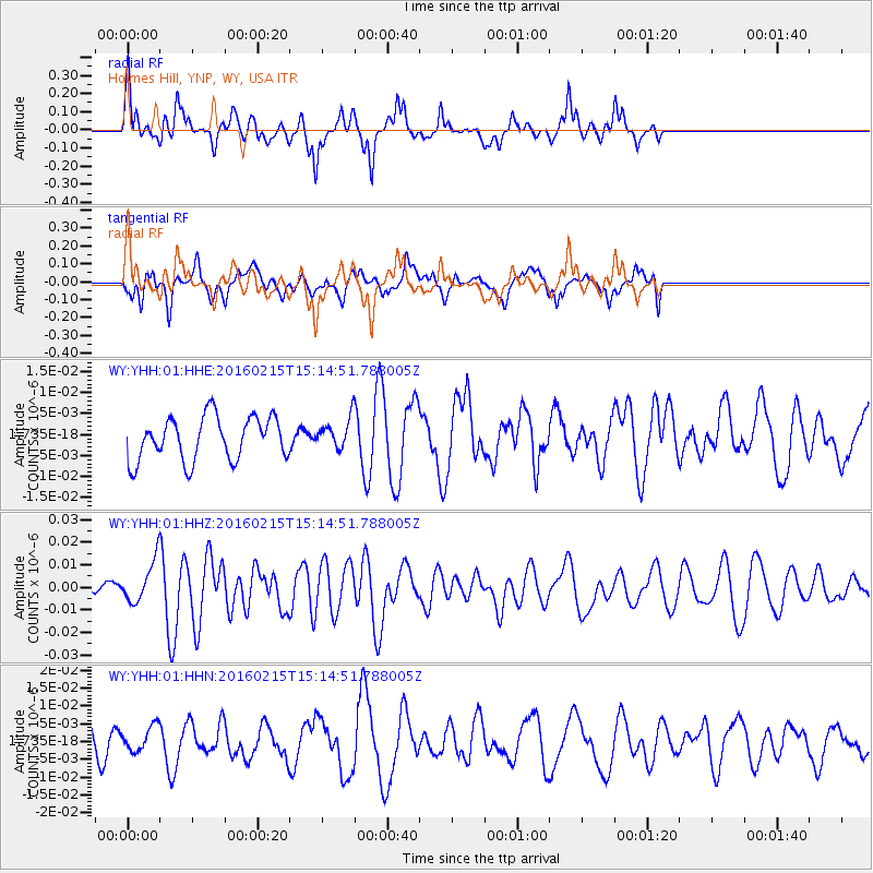
YHH Holmes Hill, YNP, WY, USA - Earthquake Result Viewer
*The percent match for this event was below the threshold and hence no stack was calculated.
| Earthquake location: |
Tonga Islands |
| Earthquake latitude/longitude: |
-21.0/-175.5 |
| Earthquake time(UTC): |
2016/02/15 (046) 15:02:33 GMT |
| Earthquake Depth: |
10 km |
| Earthquake Magnitude: |
5.7 MB |
| Earthquake Catalog/Contributor: |
NEIC PDE/NEIC COMCAT |
|
| Network: |
WY Yellowstone Wyoming Seismic Network |
| Station: |
YHH Holmes Hill, YNP, WY, USA |
| Lat/Lon: |
44.79 N/110.85 W |
| Elevation: |
2717 m |
|
| Distance: |
88.0 deg |
| Az: |
40.091 deg |
| Baz: |
237.673 deg |
| Ray Param: |
$rayparam |
*The percent match for this event was below the threshold and hence was not used in the summary stack. |
|
| Radial Match: |
64.0521 % |
| Radial Bump: |
400 |
| Transverse Match: |
61.855774 % |
| Transverse Bump: |
400 |
| SOD ConfigId: |
1427151 |
| Insert Time: |
2016-02-29 17:52:19.496 +0000 |
| GWidth: |
2.5 |
| Max Bumps: |
400 |
| Tol: |
0.001 |
|
Signal To Noise
| Channel | StoN | STA | LTA |
| WY:YHH:01:HHZ:20160215T15:14:51.788005Z | 1.7795068 | 8.958615E-9 | 5.0343245E-9 |
| WY:YHH:01:HHN:20160215T15:14:51.788005Z | 1.1674715 | 3.410237E-9 | 2.9210452E-9 |
| WY:YHH:01:HHE:20160215T15:14:51.788005Z | 0.66929644 | 3.4570935E-9 | 5.1652647E-9 |
| Arrivals |
| Ps | |
| PpPs | |
| PsPs/PpSs | |


