You are here: Home > Network List > CI - Caltech Regional Seismic Network Stations List
> Station MPM Manuel Prospect Mine, California, USA > Earthquake Result Viewer
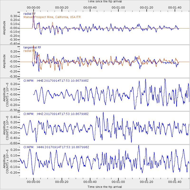
MPM Manuel Prospect Mine, California, USA - Earthquake Result Viewer
*The percent match for this event was below the threshold and hence no stack was calculated.
| Earthquake location: |
Mariana Islands |
| Earthquake latitude/longitude: |
18.7/145.7 |
| Earthquake time(UTC): |
2017/09/14 (257) 17:41:28 GMT |
| Earthquake Depth: |
173 km |
| Earthquake Magnitude: |
5.8 mww |
| Earthquake Catalog/Contributor: |
NEIC PDE/us |
|
| Network: |
CI Caltech Regional Seismic Network |
| Station: |
MPM Manuel Prospect Mine, California, USA |
| Lat/Lon: |
36.06 N/117.49 W |
| Elevation: |
185 m |
|
| Distance: |
84.5 deg |
| Az: |
53.935 deg |
| Baz: |
288.96 deg |
| Ray Param: |
$rayparam |
*The percent match for this event was below the threshold and hence was not used in the summary stack. |
|
| Radial Match: |
71.37265 % |
| Radial Bump: |
400 |
| Transverse Match: |
66.81135 % |
| Transverse Bump: |
400 |
| SOD ConfigId: |
13570011 |
| Insert Time: |
2019-04-28 18:51:53.566 +0000 |
| GWidth: |
2.5 |
| Max Bumps: |
400 |
| Tol: |
0.001 |
|
Signal To Noise
| Channel | StoN | STA | LTA |
| CI:MPM: :HHZ:20170914T17:53:10.867998Z | 2.8848104 | 2.1982005E-7 | 7.6199136E-8 |
| CI:MPM: :HHN:20170914T17:53:10.867998Z | 1.9763895 | 1.2150825E-7 | 6.147991E-8 |
| CI:MPM: :HHE:20170914T17:53:10.867998Z | 1.1870109 | 7.80688E-8 | 6.5769235E-8 |
| Arrivals |
| Ps | |
| PpPs | |
| PsPs/PpSs | |


