You are here: Home > Network List > WY - Yellowstone Wyoming Seismic Network Stations List
> Station YUF Upper Falls, WY, USA > Earthquake Result Viewer
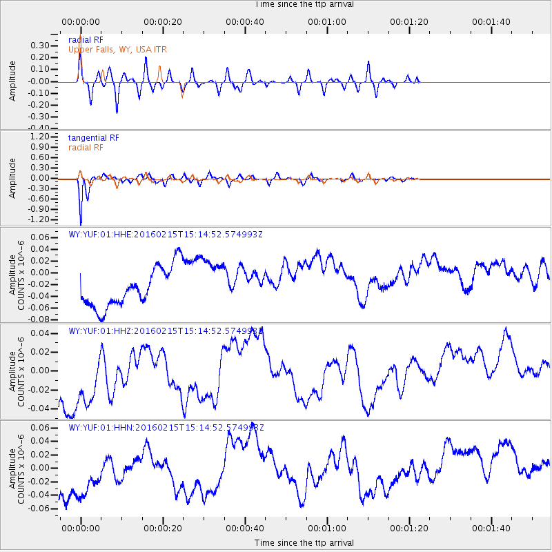
YUF Upper Falls, WY, USA - Earthquake Result Viewer
*The percent match for this event was below the threshold and hence no stack was calculated.
| Earthquake location: |
Tonga Islands |
| Earthquake latitude/longitude: |
-21.0/-175.5 |
| Earthquake time(UTC): |
2016/02/15 (046) 15:02:33 GMT |
| Earthquake Depth: |
10 km |
| Earthquake Magnitude: |
5.7 MB |
| Earthquake Catalog/Contributor: |
NEIC PDE/NEIC COMCAT |
|
| Network: |
WY Yellowstone Wyoming Seismic Network |
| Station: |
YUF Upper Falls, WY, USA |
| Lat/Lon: |
44.71 N/110.51 W |
| Elevation: |
2394 m |
|
| Distance: |
88.2 deg |
| Az: |
40.284 deg |
| Baz: |
237.917 deg |
| Ray Param: |
$rayparam |
*The percent match for this event was below the threshold and hence was not used in the summary stack. |
|
| Radial Match: |
50.69738 % |
| Radial Bump: |
400 |
| Transverse Match: |
93.99262 % |
| Transverse Bump: |
400 |
| SOD ConfigId: |
1427151 |
| Insert Time: |
2016-02-29 17:52:32.126 +0000 |
| GWidth: |
2.5 |
| Max Bumps: |
400 |
| Tol: |
0.001 |
|
Signal To Noise
| Channel | StoN | STA | LTA |
| WY:YUF:01:HHZ:20160215T15:14:52.574993Z | 1.3583366 | 6.5066956E-8 | 4.7901942E-8 |
| WY:YUF:01:HHN:20160215T15:14:52.574993Z | 1.3803324 | 7.755301E-8 | 5.61843E-8 |
| WY:YUF:01:HHE:20160215T15:14:52.574993Z | 1.3586494 | 4.4348717E-8 | 3.2641765E-8 |
| Arrivals |
| Ps | |
| PpPs | |
| PsPs/PpSs | |


