You are here: Home > Network List > TA - USArray Transportable Network (new EarthScope stations) Stations List
> Station F26K Sheenjek River, AK, USA > Earthquake Result Viewer
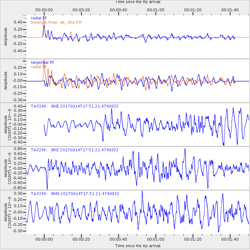
F26K Sheenjek River, AK, USA - Earthquake Result Viewer
*The percent match for this event was below the threshold and hence no stack was calculated.
| Earthquake location: |
Mariana Islands |
| Earthquake latitude/longitude: |
18.7/145.7 |
| Earthquake time(UTC): |
2017/09/14 (257) 17:41:28 GMT |
| Earthquake Depth: |
173 km |
| Earthquake Magnitude: |
5.8 mww |
| Earthquake Catalog/Contributor: |
NEIC PDE/us |
|
| Network: |
TA USArray Transportable Network (new EarthScope stations) |
| Station: |
F26K Sheenjek River, AK, USA |
| Lat/Lon: |
67.69 N/144.15 W |
| Elevation: |
683 m |
|
| Distance: |
65.3 deg |
| Az: |
23.266 deg |
| Baz: |
258.804 deg |
| Ray Param: |
$rayparam |
*The percent match for this event was below the threshold and hence was not used in the summary stack. |
|
| Radial Match: |
59.393433 % |
| Radial Bump: |
400 |
| Transverse Match: |
60.385296 % |
| Transverse Bump: |
400 |
| SOD ConfigId: |
13570011 |
| Insert Time: |
2019-04-28 18:55:11.233 +0000 |
| GWidth: |
2.5 |
| Max Bumps: |
400 |
| Tol: |
0.001 |
|
Signal To Noise
| Channel | StoN | STA | LTA |
| TA:F26K: :BHZ:20170914T17:51:21.474993Z | 2.2200825 | 2.758173E-7 | 1.2423742E-7 |
| TA:F26K: :BHN:20170914T17:51:21.474993Z | 0.88824207 | 6.639652E-8 | 7.475048E-8 |
| TA:F26K: :BHE:20170914T17:51:21.474993Z | 1.7744081 | 1.3120136E-7 | 7.394091E-8 |
| Arrivals |
| Ps | |
| PpPs | |
| PsPs/PpSs | |


