You are here: Home > Network List > TA - USArray Transportable Network (new EarthScope stations) Stations List
> Station G21K Allakaket, AK, USA > Earthquake Result Viewer
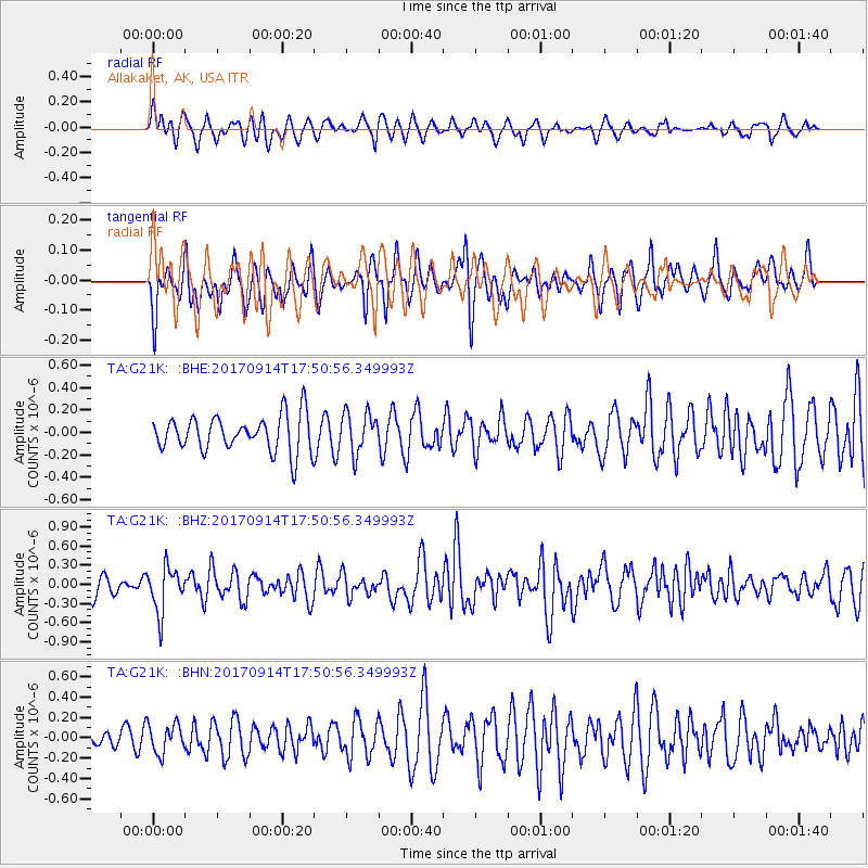
G21K Allakaket, AK, USA - Earthquake Result Viewer
*The percent match for this event was below the threshold and hence no stack was calculated.
| Earthquake location: |
Mariana Islands |
| Earthquake latitude/longitude: |
18.7/145.7 |
| Earthquake time(UTC): |
2017/09/14 (257) 17:41:28 GMT |
| Earthquake Depth: |
173 km |
| Earthquake Magnitude: |
5.8 mww |
| Earthquake Catalog/Contributor: |
NEIC PDE/us |
|
| Network: |
TA USArray Transportable Network (new EarthScope stations) |
| Station: |
G21K Allakaket, AK, USA |
| Lat/Lon: |
66.52 N/153.51 W |
| Elevation: |
446 m |
|
| Distance: |
61.5 deg |
| Az: |
23.447 deg |
| Baz: |
250.268 deg |
| Ray Param: |
$rayparam |
*The percent match for this event was below the threshold and hence was not used in the summary stack. |
|
| Radial Match: |
52.35163 % |
| Radial Bump: |
400 |
| Transverse Match: |
72.43757 % |
| Transverse Bump: |
386 |
| SOD ConfigId: |
13570011 |
| Insert Time: |
2019-04-28 18:55:15.586 +0000 |
| GWidth: |
2.5 |
| Max Bumps: |
400 |
| Tol: |
0.001 |
|
Signal To Noise
| Channel | StoN | STA | LTA |
| TA:G21K: :BHZ:20170914T17:50:56.349993Z | 2.811018 | 3.5073444E-7 | 1.2477132E-7 |
| TA:G21K: :BHN:20170914T17:50:56.349993Z | 0.93226147 | 1.4092062E-7 | 1.5115997E-7 |
| TA:G21K: :BHE:20170914T17:50:56.349993Z | 1.1228484 | 1.7991606E-7 | 1.6023183E-7 |
| Arrivals |
| Ps | |
| PpPs | |
| PsPs/PpSs | |


