You are here: Home > Network List > TA - USArray Transportable Network (new EarthScope stations) Stations List
> Station H16K Elim, AK, USA > Earthquake Result Viewer
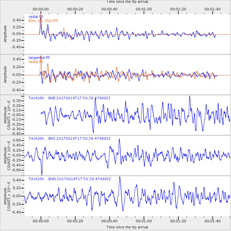
H16K Elim, AK, USA - Earthquake Result Viewer
*The percent match for this event was below the threshold and hence no stack was calculated.
| Earthquake location: |
Mariana Islands |
| Earthquake latitude/longitude: |
18.7/145.7 |
| Earthquake time(UTC): |
2017/09/14 (257) 17:41:28 GMT |
| Earthquake Depth: |
173 km |
| Earthquake Magnitude: |
5.8 mww |
| Earthquake Catalog/Contributor: |
NEIC PDE/us |
|
| Network: |
TA USArray Transportable Network (new EarthScope stations) |
| Station: |
H16K Elim, AK, USA |
| Lat/Lon: |
64.64 N/162.24 W |
| Elevation: |
216 m |
|
| Distance: |
57.4 deg |
| Az: |
23.759 deg |
| Baz: |
242.48 deg |
| Ray Param: |
$rayparam |
*The percent match for this event was below the threshold and hence was not used in the summary stack. |
|
| Radial Match: |
72.333694 % |
| Radial Bump: |
400 |
| Transverse Match: |
65.31573 % |
| Transverse Bump: |
400 |
| SOD ConfigId: |
13570011 |
| Insert Time: |
2019-04-28 18:55:22.442 +0000 |
| GWidth: |
2.5 |
| Max Bumps: |
400 |
| Tol: |
0.001 |
|
Signal To Noise
| Channel | StoN | STA | LTA |
| TA:H16K: :BHZ:20170914T17:50:28.474993Z | 2.9942064 | 2.8092322E-7 | 9.382226E-8 |
| TA:H16K: :BHN:20170914T17:50:28.474993Z | 0.7137157 | 5.7573942E-8 | 8.0667895E-8 |
| TA:H16K: :BHE:20170914T17:50:28.474993Z | 2.1632414 | 1.7859863E-7 | 8.256065E-8 |
| Arrivals |
| Ps | |
| PpPs | |
| PsPs/PpSs | |


