You are here: Home > Network List > TA - USArray Transportable Network (new EarthScope stations) Stations List
> Station P17K Kvichak River, AK, USA > Earthquake Result Viewer
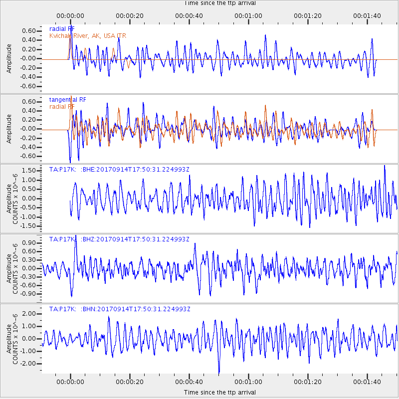
P17K Kvichak River, AK, USA - Earthquake Result Viewer
*The percent match for this event was below the threshold and hence no stack was calculated.
| Earthquake location: |
Mariana Islands |
| Earthquake latitude/longitude: |
18.7/145.7 |
| Earthquake time(UTC): |
2017/09/14 (257) 17:41:28 GMT |
| Earthquake Depth: |
173 km |
| Earthquake Magnitude: |
5.8 mww |
| Earthquake Catalog/Contributor: |
NEIC PDE/us |
|
| Network: |
TA USArray Transportable Network (new EarthScope stations) |
| Station: |
P17K Kvichak River, AK, USA |
| Lat/Lon: |
59.20 N/156.44 W |
| Elevation: |
91 m |
|
| Distance: |
57.8 deg |
| Az: |
30.978 deg |
| Baz: |
251.465 deg |
| Ray Param: |
$rayparam |
*The percent match for this event was below the threshold and hence was not used in the summary stack. |
|
| Radial Match: |
63.549126 % |
| Radial Bump: |
400 |
| Transverse Match: |
58.88617 % |
| Transverse Bump: |
400 |
| SOD ConfigId: |
13570011 |
| Insert Time: |
2019-04-28 18:56:22.734 +0000 |
| GWidth: |
2.5 |
| Max Bumps: |
400 |
| Tol: |
0.001 |
|
Signal To Noise
| Channel | StoN | STA | LTA |
| TA:P17K: :BHZ:20170914T17:50:31.224993Z | 2.6000164 | 4.952654E-7 | 1.9048551E-7 |
| TA:P17K: :BHN:20170914T17:50:31.224993Z | 0.5484321 | 3.0757806E-7 | 5.608316E-7 |
| TA:P17K: :BHE:20170914T17:50:31.224993Z | 1.0580435 | 5.2513076E-7 | 4.9632246E-7 |
| Arrivals |
| Ps | |
| PpPs | |
| PsPs/PpSs | |


