You are here: Home > Network List > CN - Canadian National Seismograph Network Stations List
> Station INK INUVIK, NT > Earthquake Result Viewer
INK INUVIK, NT - Earthquake Result Viewer
*The percent match for this event was below the threshold and hence no stack was calculated.
| Earthquake location: |
Northern Xinjiang, China |
| Earthquake latitude/longitude: |
42.2/83.5 |
| Earthquake time(UTC): |
2017/09/16 (259) 10:11:33 GMT |
| Earthquake Depth: |
16 km |
| Earthquake Magnitude: |
5.4 Mww |
| Earthquake Catalog/Contributor: |
NEIC PDE/us |
|
| Network: |
CN Canadian National Seismograph Network |
| Station: |
INK INUVIK, NT |
| Lat/Lon: |
68.31 N/133.53 W |
| Elevation: |
44 m |
|
| Distance: |
66.4 deg |
| Az: |
14.15 deg |
| Baz: |
330.756 deg |
| Ray Param: |
$rayparam |
*The percent match for this event was below the threshold and hence was not used in the summary stack. |
|
| Radial Match: |
69.33256 % |
| Radial Bump: |
400 |
| Transverse Match: |
42.566563 % |
| Transverse Bump: |
400 |
| SOD ConfigId: |
13570011 |
| Insert Time: |
2019-04-28 19:02:25.881 +0000 |
| GWidth: |
2.5 |
| Max Bumps: |
400 |
| Tol: |
0.001 |
|
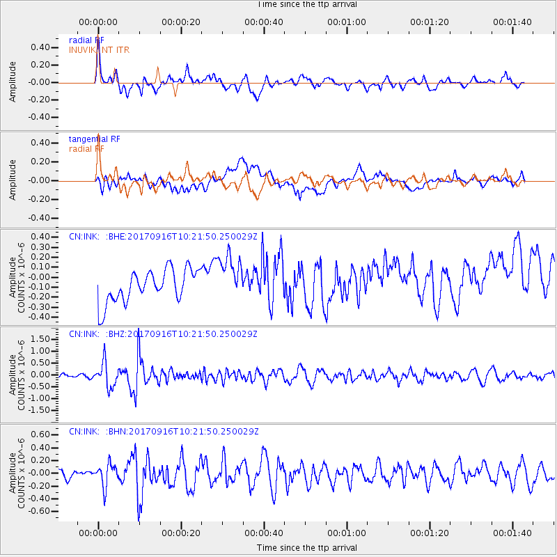
Signal To Noise
| Channel | StoN | STA | LTA |
| CN:INK: :BHZ:20170916T10:21:50.250029Z | 4.4087577 | 5.283646E-7 | 1.1984432E-7 |
| CN:INK: :BHN:20170916T10:21:50.250029Z | 1.949741 | 1.7988398E-7 | 9.226046E-8 |
| CN:INK: :BHE:20170916T10:21:50.250029Z | 1.4095565 | 2.2988205E-7 | 1.6308822E-7 |
| Arrivals |
| Ps | |
| PpPs | |
| PsPs/PpSs | |


