You are here: Home > Network List > G - GEOSCOPE Stations List
> Station MBO M'Bour, Senegal > Earthquake Result Viewer
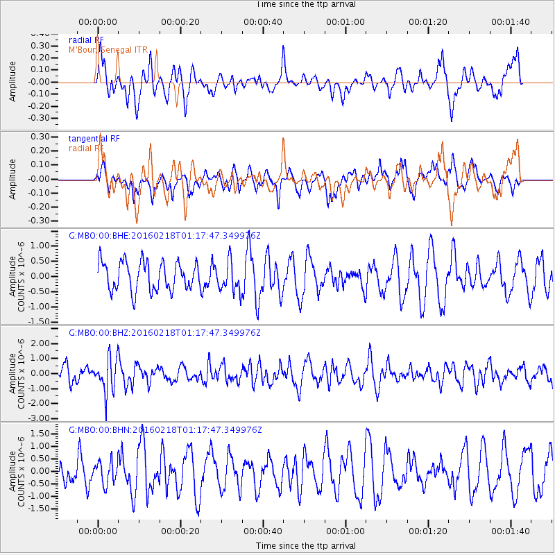
MBO M'Bour, Senegal - Earthquake Result Viewer
*The percent match for this event was below the threshold and hence no stack was calculated.
| Earthquake location: |
South Sandwich Islands Region |
| Earthquake latitude/longitude: |
-56.2/-27.6 |
| Earthquake time(UTC): |
2016/02/18 (049) 01:07:14 GMT |
| Earthquake Depth: |
119 km |
| Earthquake Magnitude: |
5.8 MB |
| Earthquake Catalog/Contributor: |
NEIC PDE/NEIC ALERT |
|
| Network: |
G GEOSCOPE |
| Station: |
MBO M'Bour, Senegal |
| Lat/Lon: |
14.39 N/16.95 W |
| Elevation: |
3.0 m |
|
| Distance: |
70.9 deg |
| Az: |
10.943 deg |
| Baz: |
186.283 deg |
| Ray Param: |
$rayparam |
*The percent match for this event was below the threshold and hence was not used in the summary stack. |
|
| Radial Match: |
42.880283 % |
| Radial Bump: |
400 |
| Transverse Match: |
53.624287 % |
| Transverse Bump: |
400 |
| SOD ConfigId: |
1427151 |
| Insert Time: |
2016-03-03 01:20:14.170 +0000 |
| GWidth: |
2.5 |
| Max Bumps: |
400 |
| Tol: |
0.001 |
|
Signal To Noise
| Channel | StoN | STA | LTA |
| G:MBO:00:BHZ:20160218T01:17:47.349976Z | 2.3182526 | 1.1694765E-6 | 5.0446465E-7 |
| G:MBO:00:BHN:20160218T01:17:47.349976Z | 0.9358733 | 4.727809E-7 | 5.0517616E-7 |
| G:MBO:00:BHE:20160218T01:17:47.349976Z | 1.0907749 | 5.15112E-7 | 4.7224407E-7 |
| Arrivals |
| Ps | |
| PpPs | |
| PsPs/PpSs | |


