You are here: Home > Network List > GT - Global Telemetered Seismograph Network (USAF/USGS) Stations List
> Station LPAZ La Paz , Bolivia > Earthquake Result Viewer
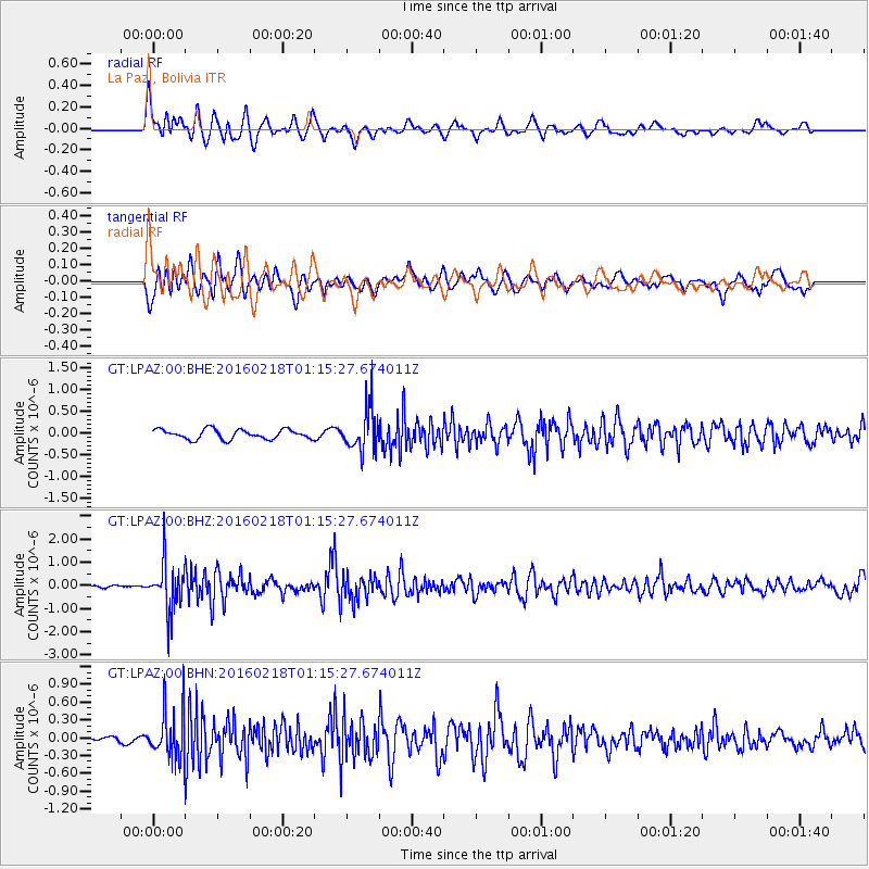
LPAZ La Paz , Bolivia - Earthquake Result Viewer
*The percent match for this event was below the threshold and hence no stack was calculated.
| Earthquake location: |
South Sandwich Islands Region |
| Earthquake latitude/longitude: |
-56.2/-27.6 |
| Earthquake time(UTC): |
2016/02/18 (049) 01:07:14 GMT |
| Earthquake Depth: |
119 km |
| Earthquake Magnitude: |
5.8 MB |
| Earthquake Catalog/Contributor: |
NEIC PDE/NEIC ALERT |
|
| Network: |
GT Global Telemetered Seismograph Network (USAF/USGS) |
| Station: |
LPAZ La Paz , Bolivia |
| Lat/Lon: |
16.17 S/68.08 W |
| Elevation: |
4817 m |
|
| Distance: |
50.4 deg |
| Az: |
305.925 deg |
| Baz: |
151.912 deg |
| Ray Param: |
$rayparam |
*The percent match for this event was below the threshold and hence was not used in the summary stack. |
|
| Radial Match: |
79.47326 % |
| Radial Bump: |
400 |
| Transverse Match: |
72.59668 % |
| Transverse Bump: |
400 |
| SOD ConfigId: |
1427151 |
| Insert Time: |
2016-03-03 01:20:49.219 +0000 |
| GWidth: |
2.5 |
| Max Bumps: |
400 |
| Tol: |
0.001 |
|
Signal To Noise
| Channel | StoN | STA | LTA |
| GT:LPAZ:00:BHZ:20160218T01:15:27.674011Z | 15.219087 | 1.0394448E-6 | 6.829876E-8 |
| GT:LPAZ:00:BHN:20160218T01:15:27.674011Z | 5.2471843 | 3.9371784E-7 | 7.5034116E-8 |
| GT:LPAZ:00:BHE:20160218T01:15:27.674011Z | 4.5273156 | 4.9865463E-7 | 1.1014355E-7 |
| Arrivals |
| Ps | |
| PpPs | |
| PsPs/PpSs | |


