You are here: Home > Network List > CI - Caltech Regional Seismic Network Stations List
> Station SMM Simmler, CA, USA > Earthquake Result Viewer
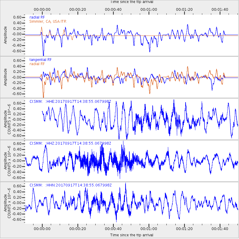
SMM Simmler, CA, USA - Earthquake Result Viewer
*The percent match for this event was below the threshold and hence no stack was calculated.
| Earthquake location: |
New Britain Region, P.N.G. |
| Earthquake latitude/longitude: |
-6.3/148.9 |
| Earthquake time(UTC): |
2017/09/17 (260) 14:26:08 GMT |
| Earthquake Depth: |
22 km |
| Earthquake Magnitude: |
5.7 Mww |
| Earthquake Catalog/Contributor: |
NEIC PDE/us |
|
| Network: |
CI Caltech Regional Seismic Network |
| Station: |
SMM Simmler, CA, USA |
| Lat/Lon: |
35.31 N/120.00 W |
| Elevation: |
599 m |
|
| Distance: |
94.5 deg |
| Az: |
55.108 deg |
| Baz: |
265.515 deg |
| Ray Param: |
$rayparam |
*The percent match for this event was below the threshold and hence was not used in the summary stack. |
|
| Radial Match: |
53.51687 % |
| Radial Bump: |
400 |
| Transverse Match: |
51.141434 % |
| Transverse Bump: |
400 |
| SOD ConfigId: |
13570011 |
| Insert Time: |
2019-04-28 19:10:24.146 +0000 |
| GWidth: |
2.5 |
| Max Bumps: |
400 |
| Tol: |
0.001 |
|
Signal To Noise
| Channel | StoN | STA | LTA |
| CI:SMM: :HHZ:20170917T14:38:55.067998Z | 2.4259846 | 3.1277375E-7 | 1.2892652E-7 |
| CI:SMM: :HHN:20170917T14:38:55.067998Z | 0.81702363 | 1.8296583E-7 | 2.2394191E-7 |
| CI:SMM: :HHE:20170917T14:38:55.067998Z | 0.93247974 | 2.517419E-7 | 2.6997037E-7 |
| Arrivals |
| Ps | |
| PpPs | |
| PsPs/PpSs | |


