You are here: Home > Network List > TA - USArray Transportable Network (new EarthScope stations) Stations List
> Station MSTX Muleshoe, TX, USA > Earthquake Result Viewer
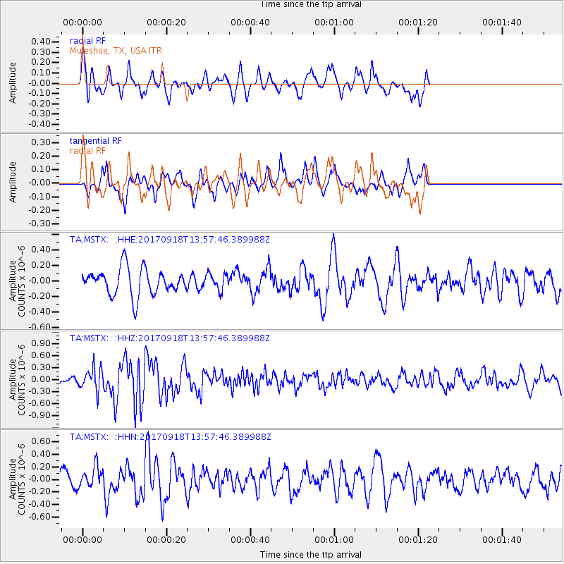
MSTX Muleshoe, TX, USA - Earthquake Result Viewer
*The percent match for this event was below the threshold and hence no stack was calculated.
| Earthquake location: |
Off Coast Of Central Chile |
| Earthquake latitude/longitude: |
-31.8/-72.1 |
| Earthquake time(UTC): |
2017/09/18 (261) 13:46:56 GMT |
| Earthquake Depth: |
10 km |
| Earthquake Magnitude: |
5.8 Mww |
| Earthquake Catalog/Contributor: |
NEIC PDE/us |
|
| Network: |
TA USArray Transportable Network (new EarthScope stations) |
| Station: |
MSTX Muleshoe, TX, USA |
| Lat/Lon: |
33.97 N/102.77 W |
| Elevation: |
1167 m |
|
| Distance: |
71.5 deg |
| Az: |
333.488 deg |
| Baz: |
152.791 deg |
| Ray Param: |
$rayparam |
*The percent match for this event was below the threshold and hence was not used in the summary stack. |
|
| Radial Match: |
62.20343 % |
| Radial Bump: |
382 |
| Transverse Match: |
54.5666 % |
| Transverse Bump: |
281 |
| SOD ConfigId: |
13570011 |
| Insert Time: |
2019-04-28 19:25:10.476 +0000 |
| GWidth: |
2.5 |
| Max Bumps: |
400 |
| Tol: |
0.001 |
|
Signal To Noise
| Channel | StoN | STA | LTA |
| TA:MSTX: :HHZ:20170918T13:57:46.389988Z | 2.8418574 | 2.77637E-7 | 9.769561E-8 |
| TA:MSTX: :HHN:20170918T13:57:46.389988Z | 1.2302825 | 1.7611629E-7 | 1.431511E-7 |
| TA:MSTX: :HHE:20170918T13:57:46.389988Z | 0.602331 | 1.0317378E-7 | 1.7129085E-7 |
| Arrivals |
| Ps | |
| PpPs | |
| PsPs/PpSs | |


