You are here: Home > Network List > TA - USArray Transportable Network (new EarthScope stations) Stations List
> Station E20K Nigu River, AK, USA > Earthquake Result Viewer
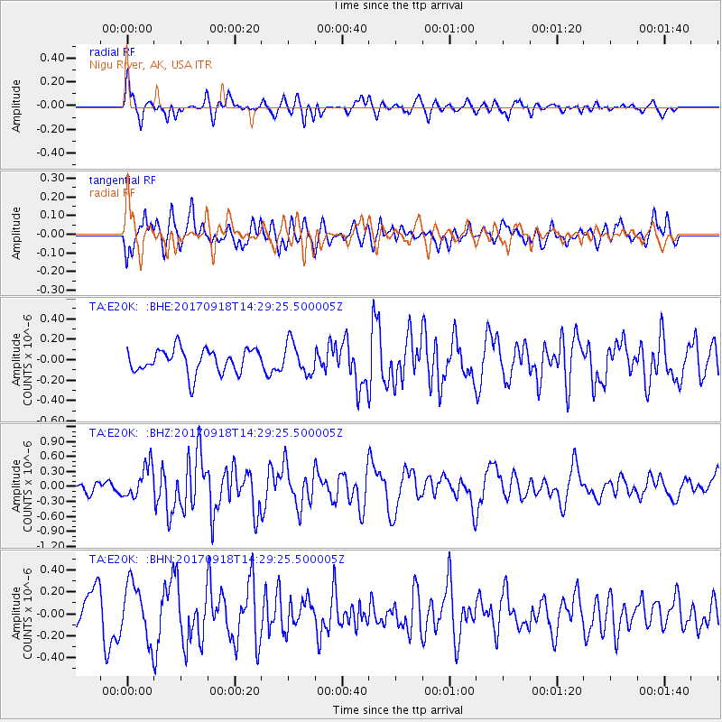
E20K Nigu River, AK, USA - Earthquake Result Viewer
*The percent match for this event was below the threshold and hence no stack was calculated.
| Earthquake location: |
Near Coast Of Oaxaca, Mexico |
| Earthquake latitude/longitude: |
15.3/-94.6 |
| Earthquake time(UTC): |
2017/09/18 (261) 14:19:12 GMT |
| Earthquake Depth: |
10 km |
| Earthquake Magnitude: |
5.6 Mww |
| Earthquake Catalog/Contributor: |
NEIC PDE/us |
|
| Network: |
TA USArray Transportable Network (new EarthScope stations) |
| Station: |
E20K Nigu River, AK, USA |
| Lat/Lon: |
68.26 N/156.19 W |
| Elevation: |
866 m |
|
| Distance: |
65.6 deg |
| Az: |
338.896 deg |
| Baz: |
111.128 deg |
| Ray Param: |
$rayparam |
*The percent match for this event was below the threshold and hence was not used in the summary stack. |
|
| Radial Match: |
65.970985 % |
| Radial Bump: |
379 |
| Transverse Match: |
42.755695 % |
| Transverse Bump: |
357 |
| SOD ConfigId: |
13570011 |
| Insert Time: |
2019-04-28 19:30:45.277 +0000 |
| GWidth: |
2.5 |
| Max Bumps: |
400 |
| Tol: |
0.001 |
|
Signal To Noise
| Channel | StoN | STA | LTA |
| TA:E20K: :BHZ:20170918T14:29:25.500005Z | 2.7925873 | 3.249027E-7 | 1.1634469E-7 |
| TA:E20K: :BHN:20170918T14:29:25.500005Z | 1.2019961 | 2.5501825E-7 | 2.121623E-7 |
| TA:E20K: :BHE:20170918T14:29:25.500005Z | 1.3110883 | 1.542387E-7 | 1.1764174E-7 |
| Arrivals |
| Ps | |
| PpPs | |
| PsPs/PpSs | |


