
I02A Mapleton, OR, USA - Earthquake Result Viewer

| ||||||||||||||||||
| ||||||||||||||||||
| ||||||||||||||||||
|
Signal To Noise
| Channel | StoN | STA | LTA |
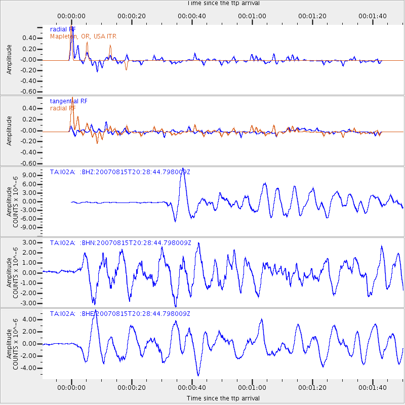
| TA:I02A: :BHN:20070815T20:28:44.798009Z | 3.072408 | 9.943898E-7 | 3.2365162E-7 |
| TA:I02A: :BHE:20070815T20:28:44.798009Z | 7.201441 | 1.043308E-6 | 1.4487489E-7 |
| TA:I02A: :BHZ:20070815T20:28:44.798009Z | 20.233852 | 2.442084E-6 | 1.2069297E-7 |
| Arrivals | |
| Ps | 2.1 SECOND |
| PpPs | 5.2 SECOND |
| PsPs/PpSs | 7.2 SECOND |

