
I02A Mapleton, OR, USA - Earthquake Result Viewer
| ||||||||||||||||||
| ||||||||||||||||||
| ||||||||||||||||||
|
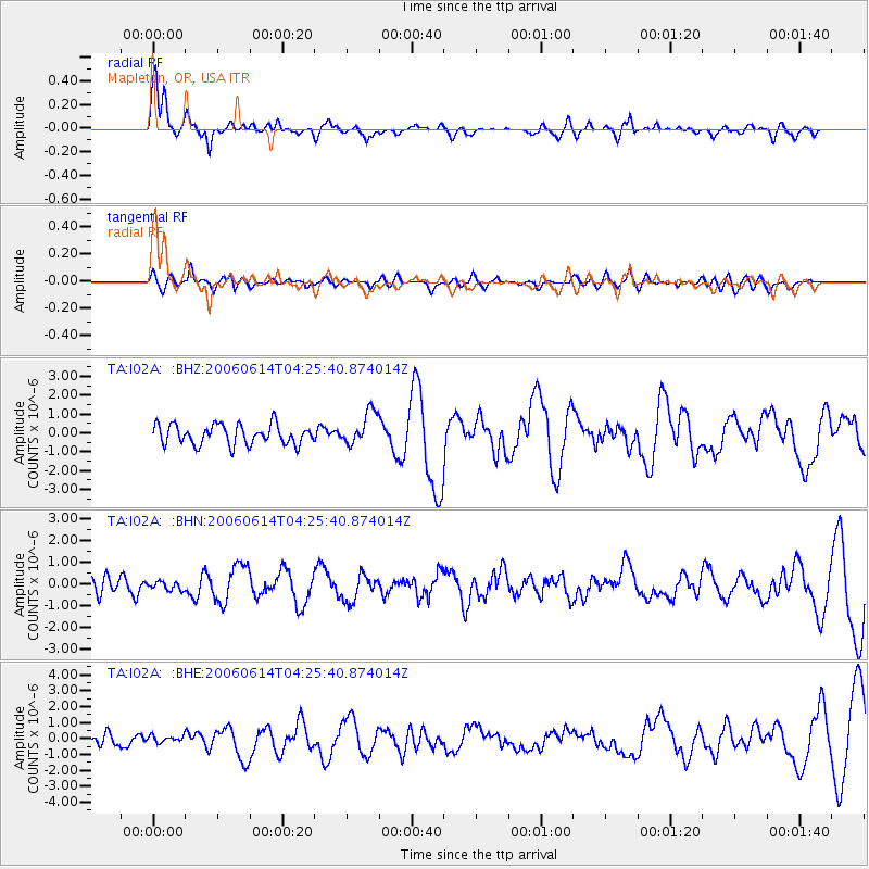
Signal To Noise
| Channel | StoN | STA | LTA |
| TA:I02A: :BHN:20060614T04:25:40.874014Z | 0.49667054 | 1.8825654E-7 | 3.7903703E-7 |
| TA:I02A: :BHE:20060614T04:25:40.874014Z | 0.65204626 | 2.2662813E-7 | 3.4756448E-7 |
| TA:I02A: :BHZ:20060614T04:25:40.874014Z | 1.6760948 | 8.7989497E-7 | 5.2496733E-7 |
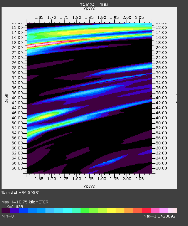
| Arrivals | |
| Ps | 2.0 SECOND |
| PpPs | 6.9 SECOND |
| PsPs/PpSs | 8.9 SECOND |

