You are here: Home > Network List > TA - USArray Transportable Network (new EarthScope stations) Stations List
> Station F20K Avaraart Lake, AK, USA > Earthquake Result Viewer
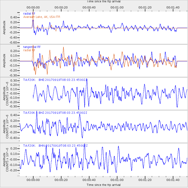
F20K Avaraart Lake, AK, USA - Earthquake Result Viewer
*The percent match for this event was below the threshold and hence no stack was calculated.
| Earthquake location: |
Near Coast Of Oaxaca, Mexico |
| Earthquake latitude/longitude: |
15.1/-94.1 |
| Earthquake time(UTC): |
2017/09/19 (262) 07:53:13 GMT |
| Earthquake Depth: |
16 km |
| Earthquake Magnitude: |
5.5 Mww |
| Earthquake Catalog/Contributor: |
NEIC PDE/us |
|
| Network: |
TA USArray Transportable Network (new EarthScope stations) |
| Station: |
F20K Avaraart Lake, AK, USA |
| Lat/Lon: |
67.05 N/155.73 W |
| Elevation: |
136 m |
|
| Distance: |
65.3 deg |
| Az: |
337.665 deg |
| Baz: |
110.628 deg |
| Ray Param: |
$rayparam |
*The percent match for this event was below the threshold and hence was not used in the summary stack. |
|
| Radial Match: |
60.416374 % |
| Radial Bump: |
398 |
| Transverse Match: |
54.52152 % |
| Transverse Bump: |
400 |
| SOD ConfigId: |
13570011 |
| Insert Time: |
2019-04-28 19:36:01.671 +0000 |
| GWidth: |
2.5 |
| Max Bumps: |
400 |
| Tol: |
0.001 |
|
Signal To Noise
| Channel | StoN | STA | LTA |
| TA:F20K: :BHZ:20170919T08:03:23.45002Z | 1.6396576 | 1.9255248E-7 | 1.1743457E-7 |
| TA:F20K: :BHN:20170919T08:03:23.45002Z | 0.7831548 | 7.7442124E-8 | 9.888482E-8 |
| TA:F20K: :BHE:20170919T08:03:23.45002Z | 1.2287328 | 1.3069597E-7 | 1.06366464E-7 |
| Arrivals |
| Ps | |
| PpPs | |
| PsPs/PpSs | |


