You are here: Home > Network List > IU - Global Seismograph Network (GSN - IRIS/USGS) Stations List
> Station CTAO Charters Towers, Australia > Earthquake Result Viewer
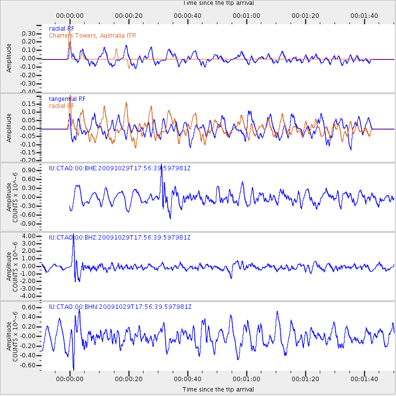
CTAO Charters Towers, Australia - Earthquake Result Viewer
*The percent match for this event was below the threshold and hence no stack was calculated.
| Earthquake location: |
Hindu Kush Region, Afghanistan |
| Earthquake latitude/longitude: |
36.4/70.7 |
| Earthquake time(UTC): |
2009/10/29 (302) 17:44:31 GMT |
| Earthquake Depth: |
202 km |
| Earthquake Magnitude: |
5.9 MB, 6.2 MW, 6.2 MW |
| Earthquake Catalog/Contributor: |
WHDF/NEIC |
|
| Network: |
IU Global Seismograph Network (GSN - IRIS/USGS) |
| Station: |
CTAO Charters Towers, Australia |
| Lat/Lon: |
20.09 S/146.25 E |
| Elevation: |
357 m |
|
| Distance: |
90.7 deg |
| Az: |
114.473 deg |
| Baz: |
308.613 deg |
| Ray Param: |
$rayparam |
*The percent match for this event was below the threshold and hence was not used in the summary stack. |
|
| Radial Match: |
64.74094 % |
| Radial Bump: |
400 |
| Transverse Match: |
52.41657 % |
| Transverse Bump: |
400 |
| SOD ConfigId: |
1 |
| Insert Time: |
2010-02-19 00:59:30.001 +0000 |
| GWidth: |
2.5 |
| Max Bumps: |
400 |
| Tol: |
0.001 |
|
Signal To Noise
| Channel | StoN | STA | LTA |
| IU:CTAO:00:BHZ:20091029T17:56:39.597981Z | 5.802808 | 1.4246177E-6 | 2.455049E-7 |
| IU:CTAO:00:BHN:20091029T17:56:39.597981Z | 1.7028317 | 3.0959725E-7 | 1.8181318E-7 |
| IU:CTAO:00:BHE:20091029T17:56:39.597981Z | 1.7889563 | 4.036028E-7 | 2.2560798E-7 |
| Arrivals |
| Ps | |
| PpPs | |
| PsPs/PpSs | |


