You are here: Home > Network List > GS - US Geological Survey Networks Stations List
> Station KAN13 Rinehart Farm, , CA, USA > Earthquake Result Viewer
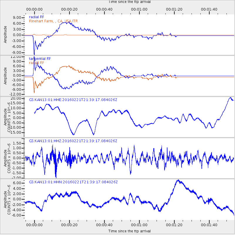
KAN13 Rinehart Farm, , CA, USA - Earthquake Result Viewer
*The percent match for this event was below the threshold and hence no stack was calculated.
| Earthquake location: |
Volcano Islands, Japan Region |
| Earthquake latitude/longitude: |
23.6/144.3 |
| Earthquake time(UTC): |
2016/02/21 (052) 21:26:23 GMT |
| Earthquake Depth: |
30 km |
| Earthquake Magnitude: |
5.6 MB |
| Earthquake Catalog/Contributor: |
NEIC PDE/NEIC COMCAT |
|
| Network: |
GS US Geological Survey Networks |
| Station: |
KAN13 Rinehart Farm, , CA, USA |
| Lat/Lon: |
37.01 N/97.48 W |
| Elevation: |
340 m |
|
| Distance: |
96.2 deg |
| Az: |
45.196 deg |
| Baz: |
305.591 deg |
| Ray Param: |
$rayparam |
*The percent match for this event was below the threshold and hence was not used in the summary stack. |
|
| Radial Match: |
43.913628 % |
| Radial Bump: |
400 |
| Transverse Match: |
42.517803 % |
| Transverse Bump: |
400 |
| SOD ConfigId: |
1427151 |
| Insert Time: |
2016-03-06 22:02:12.997 +0000 |
| GWidth: |
2.5 |
| Max Bumps: |
400 |
| Tol: |
0.001 |
|
Signal To Noise
| Channel | StoN | STA | LTA |
| GS:KAN13:01:HHZ:20160221T21:39:17.084026Z | 1.1633079 | 5.1335115E-7 | 4.4128572E-7 |
| GS:KAN13:01:HHN:20160221T21:39:17.084026Z | 2.030595 | 3.6184165E-6 | 1.7819488E-6 |
| GS:KAN13:01:HHE:20160221T21:39:17.084026Z | 1.4296329 | 1.3649686E-5 | 9.547686E-6 |
| Arrivals |
| Ps | |
| PpPs | |
| PsPs/PpSs | |


