You are here: Home > Network List > TA - USArray Transportable Network (new EarthScope stations) Stations List
> Station L09A Wilkinson Ranch, McDermitt, NV, USA > Earthquake Result Viewer
L09A Wilkinson Ranch, McDermitt, NV, USA - Earthquake Result Viewer

| Earthquake location: |
North Atlantic Ocean |
| Earthquake latitude/longitude: |
53.7/-35.4 |
| Earthquake time(UTC): |
2006/11/29 (333) 15:38:44 GMT |
| Earthquake Depth: |
10 km |
| Earthquake Magnitude: |
5.6 MB, 5.3 MS, 5.6 MW, 5.6 MW |
| Earthquake Catalog/Contributor: |
WHDF/NEIC |
|
| Network: |
TA USArray Transportable Network (new EarthScope stations) |
| Station: |
L09A Wilkinson Ranch, McDermitt, NV, USA |
| Lat/Lon: |
42.02 N/117.67 W |
| Elevation: |
1430 m |
|
| Distance: |
53.4 deg |
| Az: |
293.112 deg |
| Baz: |
47.155 deg |
| Ray Param: |
0.06613087 |
| Estimated Moho Depth: |
31.25 km |
| Estimated Crust Vp/Vs: |
1.97 |
| Assumed Crust Vp: |
6.291 km/s |
| Estimated Crust Vs: |
3.194 km/s |
| Estimated Crust Poisson's Ratio: |
0.33 |
|
| Radial Match: |
80.729385 % |
| Radial Bump: |
400 |
| Transverse Match: |
66.08392 % |
| Transverse Bump: |
400 |
| SOD ConfigId: |
2564 |
| Insert Time: |
2010-03-06 03:54:57.784 +0000 |
| GWidth: |
2.5 |
| Max Bumps: |
400 |
| Tol: |
0.001 |
|
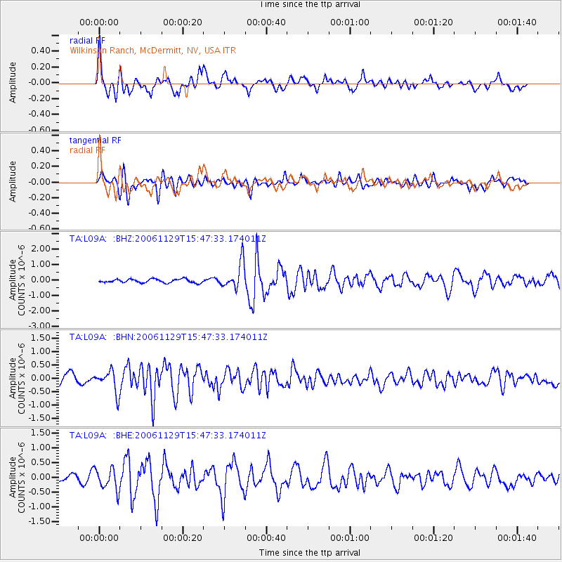
Signal To Noise
| Channel | StoN | STA | LTA |
| TA:L09A: :BHN:20061129T15:47:33.174011Z | 2.2692673 | 4.2768275E-7 | 1.8846733E-7 |
| TA:L09A: :BHE:20061129T15:47:33.174011Z | 2.4938536 | 3.5802378E-7 | 1.4356246E-7 |
| TA:L09A: :BHZ:20061129T15:47:33.174011Z | 7.483446 | 8.8106015E-7 | 1.1773455E-7 |
| Arrivals |
| Ps | 5.0 SECOND |
| PpPs | 14 SECOND |
| PsPs/PpSs | 19 SECOND |


