You are here: Home > Network List > TA - USArray Transportable Network (new EarthScope stations) Stations List
> Station MSTX Muleshoe, TX, USA > Earthquake Result Viewer
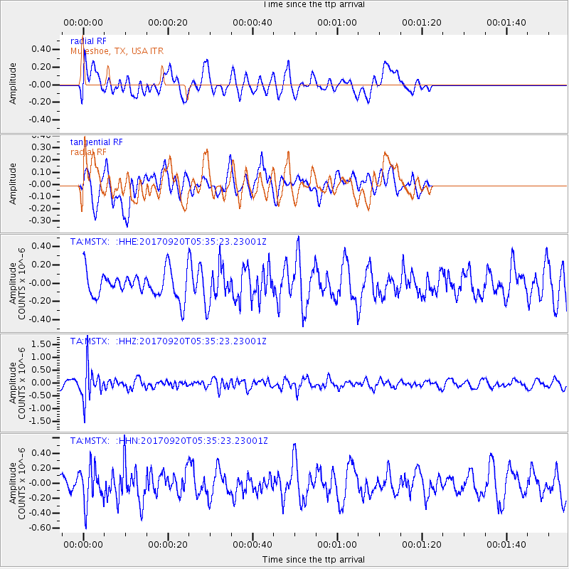
MSTX Muleshoe, TX, USA - Earthquake Result Viewer
*The percent match for this event was below the threshold and hence no stack was calculated.
| Earthquake location: |
Southern Peru |
| Earthquake latitude/longitude: |
-16.3/-71.3 |
| Earthquake time(UTC): |
2017/09/20 (263) 05:26:08 GMT |
| Earthquake Depth: |
93 km |
| Earthquake Magnitude: |
5.3 Mww |
| Earthquake Catalog/Contributor: |
NEIC PDE/us |
|
| Network: |
TA USArray Transportable Network (new EarthScope stations) |
| Station: |
MSTX Muleshoe, TX, USA |
| Lat/Lon: |
33.97 N/102.77 W |
| Elevation: |
1167 m |
|
| Distance: |
58.3 deg |
| Az: |
329.341 deg |
| Baz: |
143.892 deg |
| Ray Param: |
$rayparam |
*The percent match for this event was below the threshold and hence was not used in the summary stack. |
|
| Radial Match: |
37.81705 % |
| Radial Bump: |
400 |
| Transverse Match: |
52.834675 % |
| Transverse Bump: |
400 |
| SOD ConfigId: |
13570011 |
| Insert Time: |
2019-04-28 19:55:49.634 +0000 |
| GWidth: |
2.5 |
| Max Bumps: |
400 |
| Tol: |
0.001 |
|
Signal To Noise
| Channel | StoN | STA | LTA |
| TA:MSTX: :HHZ:20170920T05:35:23.23001Z | 6.7324486 | 6.4271336E-7 | 9.5465026E-8 |
| TA:MSTX: :HHN:20170920T05:35:23.23001Z | 1.2329245 | 2.3805933E-7 | 1.9308509E-7 |
| TA:MSTX: :HHE:20170920T05:35:23.23001Z | 1.4461944 | 2.0509847E-7 | 1.4181944E-7 |
| Arrivals |
| Ps | |
| PpPs | |
| PsPs/PpSs | |


