N10A Dunphy, NV, USA - Earthquake Result Viewer
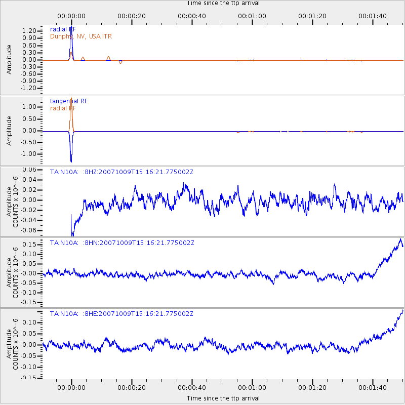
Earthquake location: New Britain Region, P.N.G.
Earthquake latitude/longitude: -4.8/152.9
Earthquake time(UTC): 2007/10/09 (282) 15:03:41 GMT
Earthquake Depth: 39 km
Earthquake Magnitude: 5.7 MB, 5.7 MS, 6.0 MW, 5.9 MW
Earthquake Catalog/Contributor: WHDF/NEIC
Network: TA USArray Transportable Network (new EarthScope stations)
Station: N10A Dunphy, NV, USA
Lat/Lon: 40.72 N/116.51 W
Elevation: 1392 m
Distance: 93.6 deg
Az: 49.597 deg
Baz: 266.755 deg
Ray Param: 0.041222833
Estimated Moho Depth: 10.0 km
Estimated Crust Vp/Vs: 1.60
Assumed Crust Vp: 6.276 km/s
Estimated Crust Vs: 3.922 km/s
Estimated Crust Poisson's Ratio: 0.18
Radial Match: 99.72225 %
Radial Bump: 28
Transverse Match: 99.680214 %
Transverse Bump: 23
SOD ConfigId: 2564
Insert Time: 2010-03-06 03:56:12.516 +0000
GWidth: 2.5
Max Bumps: 400
Tol: 0.001

Signal To Noise

ChannelStoNSTALTA
TA:N10A: :BHN:20071009T15:16:21.775002Z1.06192431.7889716E-81.6846508E-8
TA:N10A: :BHE:20071009T15:16:21.775002Z0.74863631.34546045E-81.7972152E-8
TA:N10A: :BHZ:20071009T15:16:21.775002Z0.78657031.3975253E-81.7767329E-8
Arrivals
Ps1.0 SECOND
PpPs4.1 SECOND
PsPs/PpSs5.0 SECOND