You are here: Home > Network List > AV - Alaska Volcano Observatory Stations List
> Station SPCR Ckakachatna River, Mount Spurr, Alaska > Earthquake Result Viewer
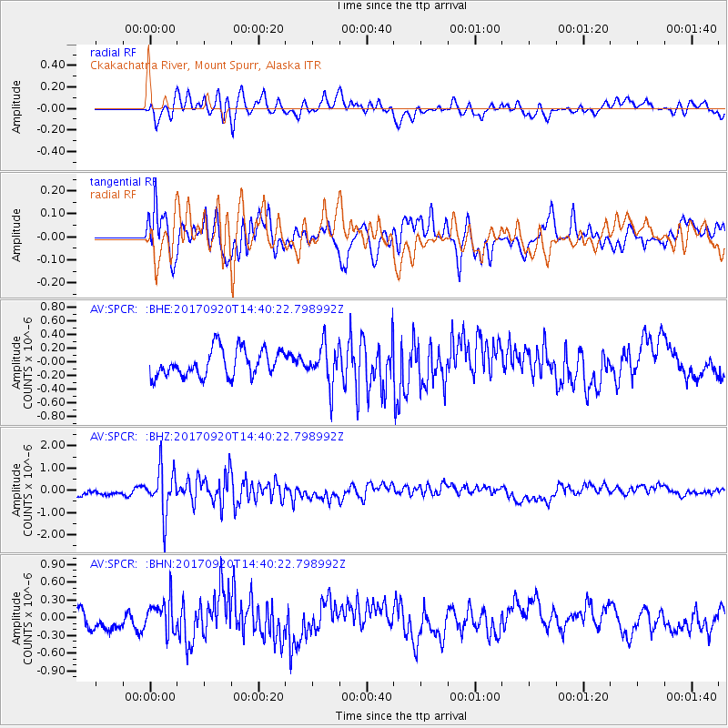
SPCR Ckakachatna River, Mount Spurr, Alaska - Earthquake Result Viewer
*The percent match for this event was below the threshold and hence no stack was calculated.
| Earthquake location: |
Taiwan |
| Earthquake latitude/longitude: |
23.3/121.8 |
| Earthquake time(UTC): |
2017/09/20 (263) 14:29:56 GMT |
| Earthquake Depth: |
22 km |
| Earthquake Magnitude: |
5.3 Mww |
| Earthquake Catalog/Contributor: |
NEIC PDE/us |
|
| Network: |
AV Alaska Volcano Observatory |
| Station: |
SPCR Ckakachatna River, Mount Spurr, Alaska |
| Lat/Lon: |
61.20 N/152.21 W |
| Elevation: |
984 m |
|
| Distance: |
68.0 deg |
| Az: |
31.404 deg |
| Baz: |
278.358 deg |
| Ray Param: |
$rayparam |
*The percent match for this event was below the threshold and hence was not used in the summary stack. |
|
| Radial Match: |
48.95142 % |
| Radial Bump: |
400 |
| Transverse Match: |
47.30024 % |
| Transverse Bump: |
400 |
| SOD ConfigId: |
13570011 |
| Insert Time: |
2019-04-28 19:59:28.787 +0000 |
| GWidth: |
2.5 |
| Max Bumps: |
400 |
| Tol: |
0.001 |
|
Signal To Noise
| Channel | StoN | STA | LTA |
| AV:SPCR: :BHZ:20170920T14:40:22.798992Z | 7.4945254 | 1.037647E-6 | 1.3845401E-7 |
| AV:SPCR: :BHN:20170920T14:40:22.798992Z | 2.0807087 | 2.780063E-7 | 1.3361135E-7 |
| AV:SPCR: :BHE:20170920T14:40:22.798992Z | 1.5015224 | 2.9285678E-7 | 1.950399E-7 |
| Arrivals |
| Ps | |
| PpPs | |
| PsPs/PpSs | |


