You are here: Home > Network List > TA - USArray Transportable Network (new EarthScope stations) Stations List
> Station N10A Dunphy, NV, USA > Earthquake Result Viewer
N10A Dunphy, NV, USA - Earthquake Result Viewer
| Earthquake location: |
Southeast Of Loyalty Islands |
| Earthquake latitude/longitude: |
-21.2/169.2 |
| Earthquake time(UTC): |
2007/09/29 (272) 15:36:44 GMT |
| Earthquake Depth: |
10 km |
| Earthquake Magnitude: |
5.5 MB, 5.4 MS, 5.7 MW, 5.6 MW |
| Earthquake Catalog/Contributor: |
WHDF/NEIC |
|
| Network: |
TA USArray Transportable Network (new EarthScope stations) |
| Station: |
N10A Dunphy, NV, USA |
| Lat/Lon: |
40.72 N/116.51 W |
| Elevation: |
1392 m |
|
| Distance: |
92.3 deg |
| Az: |
47.067 deg |
| Baz: |
244.039 deg |
| Ray Param: |
0.04147508 |
| Estimated Moho Depth: |
10.0 km |
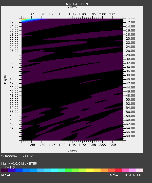
| Estimated Crust Vp/Vs: |
1.60 |
| Assumed Crust Vp: |
6.276 km/s |
| Estimated Crust Vs: |
3.922 km/s |
| Estimated Crust Poisson's Ratio: |
0.18 |
|
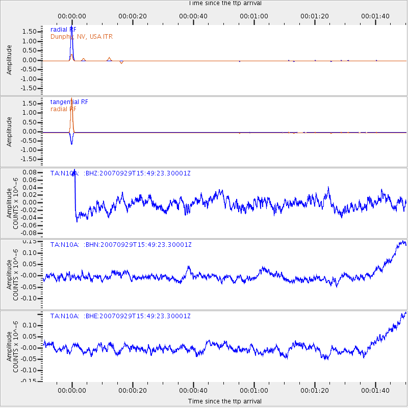
| Radial Match: |
99.74492 % |
| Radial Bump: |
25 |
| Transverse Match: |
98.82839 % |
| Transverse Bump: |
39 |
| SOD ConfigId: |
2564 |
| Insert Time: |
2010-03-06 03:56:47.749 +0000 |
| GWidth: |
2.5 |
| Max Bumps: |
400 |
| Tol: |
0.001 |
|
Signal To Noise
| Channel | StoN | STA | LTA |
| TA:N10A: :BHN:20070929T15:49:23.30001Z | 0.41250315 | 1.12697975E-8 | 2.7320512E-8 |
| TA:N10A: :BHE:20070929T15:49:23.30001Z | 0.42413244 | 1.496955E-8 | 3.5294516E-8 |
| TA:N10A: :BHZ:20070929T15:49:23.30001Z | 0.43048656 | 1.0787043E-8 | 2.5057792E-8 |
| Arrivals |
| Ps | 1.0 SECOND |
| PpPs | 4.1 SECOND |
| PsPs/PpSs | 5.0 SECOND |


