You are here: Home > Network List > TA - USArray Transportable Network (new EarthScope stations) Stations List
> Station G31M Satah River, YT, CAN > Earthquake Result Viewer
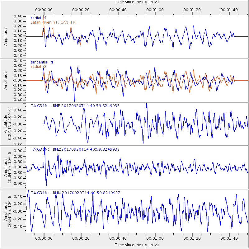
G31M Satah River, YT, CAN - Earthquake Result Viewer
*The percent match for this event was below the threshold and hence no stack was calculated.
| Earthquake location: |
Taiwan |
| Earthquake latitude/longitude: |
23.3/121.8 |
| Earthquake time(UTC): |
2017/09/20 (263) 14:29:56 GMT |
| Earthquake Depth: |
22 km |
| Earthquake Magnitude: |
5.3 Mww |
| Earthquake Catalog/Contributor: |
NEIC PDE/us |
|
| Network: |
TA USArray Transportable Network (new EarthScope stations) |
| Station: |
G31M Satah River, YT, CAN |
| Lat/Lon: |
66.92 N/134.27 W |
| Elevation: |
61 m |
|
| Distance: |
74.1 deg |
| Az: |
23.437 deg |
| Baz: |
291.919 deg |
| Ray Param: |
$rayparam |
*The percent match for this event was below the threshold and hence was not used in the summary stack. |
|
| Radial Match: |
66.0515 % |
| Radial Bump: |
400 |
| Transverse Match: |
50.899044 % |
| Transverse Bump: |
400 |
| SOD ConfigId: |
13570011 |
| Insert Time: |
2019-04-28 20:03:11.545 +0000 |
| GWidth: |
2.5 |
| Max Bumps: |
400 |
| Tol: |
0.001 |
|
Signal To Noise
| Channel | StoN | STA | LTA |
| TA:G31M: :BHZ:20170920T14:40:59.824993Z | 3.0583203 | 4.5925168E-7 | 1.5016468E-7 |
| TA:G31M: :BHN:20170920T14:40:59.824993Z | 1.1379143 | 2.4799292E-7 | 2.1793637E-7 |
| TA:G31M: :BHE:20170920T14:40:59.824993Z | 1.0525312 | 2.1049652E-7 | 1.9999077E-7 |
| Arrivals |
| Ps | |
| PpPs | |
| PsPs/PpSs | |


