You are here: Home > Network List > TA - USArray Transportable Network (new EarthScope stations) Stations List
> Station J26L Joseph Creek, AK, USA > Earthquake Result Viewer
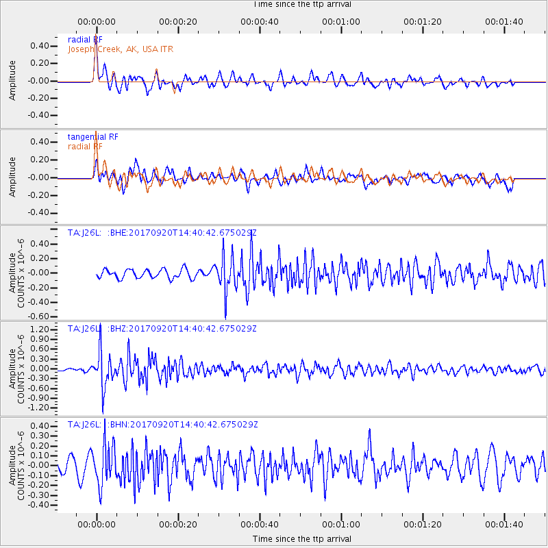
J26L Joseph Creek, AK, USA - Earthquake Result Viewer
*The percent match for this event was below the threshold and hence no stack was calculated.
| Earthquake location: |
Taiwan |
| Earthquake latitude/longitude: |
23.3/121.8 |
| Earthquake time(UTC): |
2017/09/20 (263) 14:29:56 GMT |
| Earthquake Depth: |
22 km |
| Earthquake Magnitude: |
5.3 Mww |
| Earthquake Catalog/Contributor: |
NEIC PDE/us |
|
| Network: |
TA USArray Transportable Network (new EarthScope stations) |
| Station: |
J26L Joseph Creek, AK, USA |
| Lat/Lon: |
64.50 N/143.56 W |
| Elevation: |
1144 m |
|
| Distance: |
71.2 deg |
| Az: |
27.108 deg |
| Baz: |
284.548 deg |
| Ray Param: |
$rayparam |
*The percent match for this event was below the threshold and hence was not used in the summary stack. |
|
| Radial Match: |
73.849724 % |
| Radial Bump: |
400 |
| Transverse Match: |
59.6995 % |
| Transverse Bump: |
400 |
| SOD ConfigId: |
13570011 |
| Insert Time: |
2019-04-28 20:03:33.940 +0000 |
| GWidth: |
2.5 |
| Max Bumps: |
400 |
| Tol: |
0.001 |
|
Signal To Noise
| Channel | StoN | STA | LTA |
| TA:J26L: :BHZ:20170920T14:40:42.675029Z | 6.353478 | 5.416856E-7 | 8.525813E-8 |
| TA:J26L: :BHN:20170920T14:40:42.675029Z | 2.4090998 | 2.0369016E-7 | 8.4550315E-8 |
| TA:J26L: :BHE:20170920T14:40:42.675029Z | 3.8126948 | 2.3011559E-7 | 6.03551E-8 |
| Arrivals |
| Ps | |
| PpPs | |
| PsPs/PpSs | |


