You are here: Home > Network List > TA - USArray Transportable Network (new EarthScope stations) Stations List
> Station M31M Drury Creek, Yukon, CA > Earthquake Result Viewer
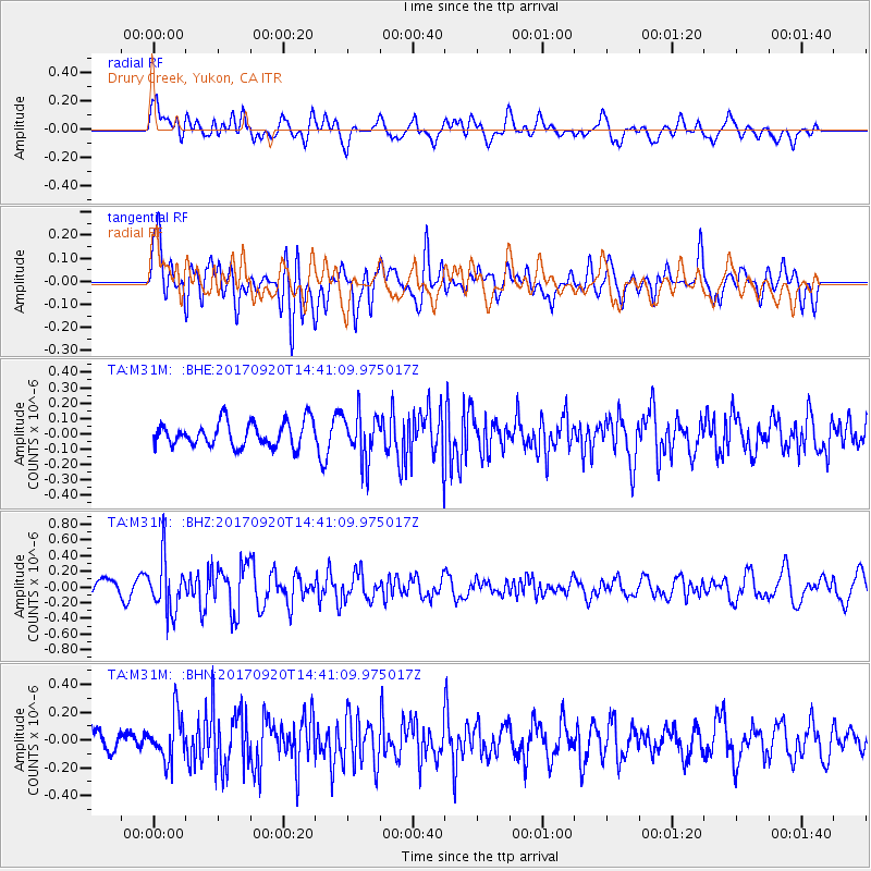
M31M Drury Creek, Yukon, CA - Earthquake Result Viewer
*The percent match for this event was below the threshold and hence no stack was calculated.
| Earthquake location: |
Taiwan |
| Earthquake latitude/longitude: |
23.3/121.8 |
| Earthquake time(UTC): |
2017/09/20 (263) 14:29:56 GMT |
| Earthquake Depth: |
22 km |
| Earthquake Magnitude: |
5.3 Mww |
| Earthquake Catalog/Contributor: |
NEIC PDE/us |
|
| Network: |
TA USArray Transportable Network (new EarthScope stations) |
| Station: |
M31M Drury Creek, Yukon, CA |
| Lat/Lon: |
62.20 N/134.39 W |
| Elevation: |
639 m |
|
| Distance: |
75.9 deg |
| Az: |
27.993 deg |
| Baz: |
292.991 deg |
| Ray Param: |
$rayparam |
*The percent match for this event was below the threshold and hence was not used in the summary stack. |
|
| Radial Match: |
60.154076 % |
| Radial Bump: |
400 |
| Transverse Match: |
54.86367 % |
| Transverse Bump: |
400 |
| SOD ConfigId: |
13570011 |
| Insert Time: |
2019-04-28 20:03:58.462 +0000 |
| GWidth: |
2.5 |
| Max Bumps: |
400 |
| Tol: |
0.001 |
|
Signal To Noise
| Channel | StoN | STA | LTA |
| TA:M31M: :BHZ:20170920T14:41:09.975017Z | 3.8244388 | 3.3312847E-7 | 8.710519E-8 |
| TA:M31M: :BHN:20170920T14:41:09.975017Z | 1.5492628 | 1.668893E-7 | 1.0772175E-7 |
| TA:M31M: :BHE:20170920T14:41:09.975017Z | 1.8345822 | 1.4731543E-7 | 8.029917E-8 |
| Arrivals |
| Ps | |
| PpPs | |
| PsPs/PpSs | |


