You are here: Home > Network List > UW - Pacific Northwest Regional Seismic Network Stations List
> Station MRBL Marblemount, WA, USA > Earthquake Result Viewer
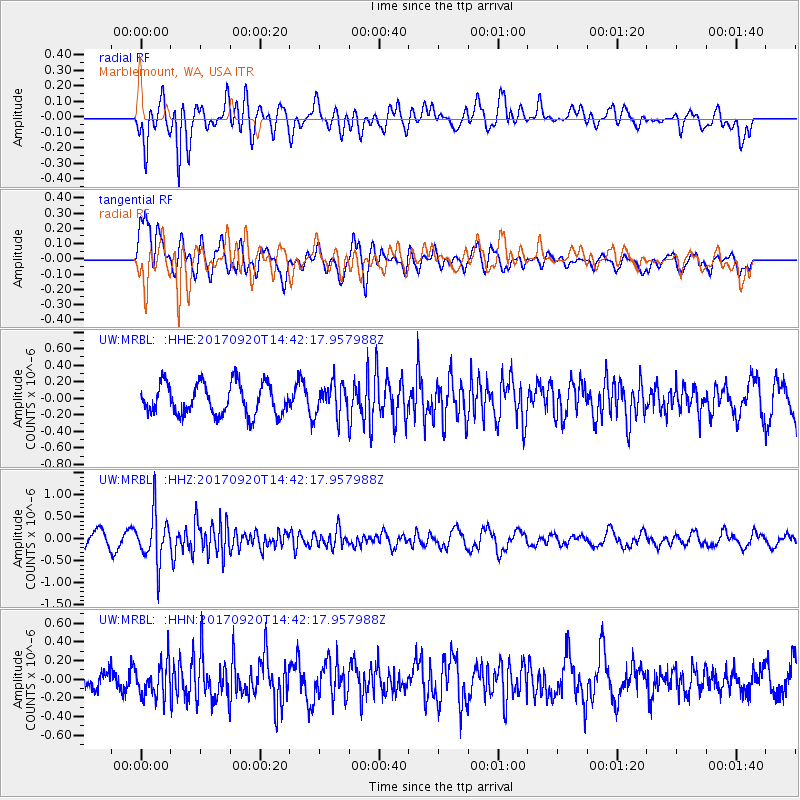
MRBL Marblemount, WA, USA - Earthquake Result Viewer
*The percent match for this event was below the threshold and hence no stack was calculated.
| Earthquake location: |
Taiwan |
| Earthquake latitude/longitude: |
23.3/121.8 |
| Earthquake time(UTC): |
2017/09/20 (263) 14:29:56 GMT |
| Earthquake Depth: |
22 km |
| Earthquake Magnitude: |
5.3 Mww |
| Earthquake Catalog/Contributor: |
NEIC PDE/us |
|
| Network: |
UW Pacific Northwest Regional Seismic Network |
| Station: |
MRBL Marblemount, WA, USA |
| Lat/Lon: |
48.52 N/121.48 W |
| Elevation: |
75 m |
|
| Distance: |
88.9 deg |
| Az: |
36.426 deg |
| Baz: |
304.802 deg |
| Ray Param: |
$rayparam |
*The percent match for this event was below the threshold and hence was not used in the summary stack. |
|
| Radial Match: |
70.0996 % |
| Radial Bump: |
400 |
| Transverse Match: |
54.36664 % |
| Transverse Bump: |
400 |
| SOD ConfigId: |
13570011 |
| Insert Time: |
2019-04-28 20:04:58.601 +0000 |
| GWidth: |
2.5 |
| Max Bumps: |
400 |
| Tol: |
0.001 |
|
Signal To Noise
| Channel | StoN | STA | LTA |
| UW:MRBL: :HHZ:20170920T14:42:17.957988Z | 2.8884451 | 5.6241845E-7 | 1.9471324E-7 |
| UW:MRBL: :HHN:20170920T14:42:17.957988Z | 1.7566512 | 1.8395917E-7 | 1.04721515E-7 |
| UW:MRBL: :HHE:20170920T14:42:17.957988Z | 1.0727454 | 2.0082662E-7 | 1.8720807E-7 |
| Arrivals |
| Ps | |
| PpPs | |
| PsPs/PpSs | |


