You are here: Home > Network List > TA - USArray Transportable Network (new EarthScope stations) Stations List
> Station N10A Dunphy, NV, USA > Earthquake Result Viewer
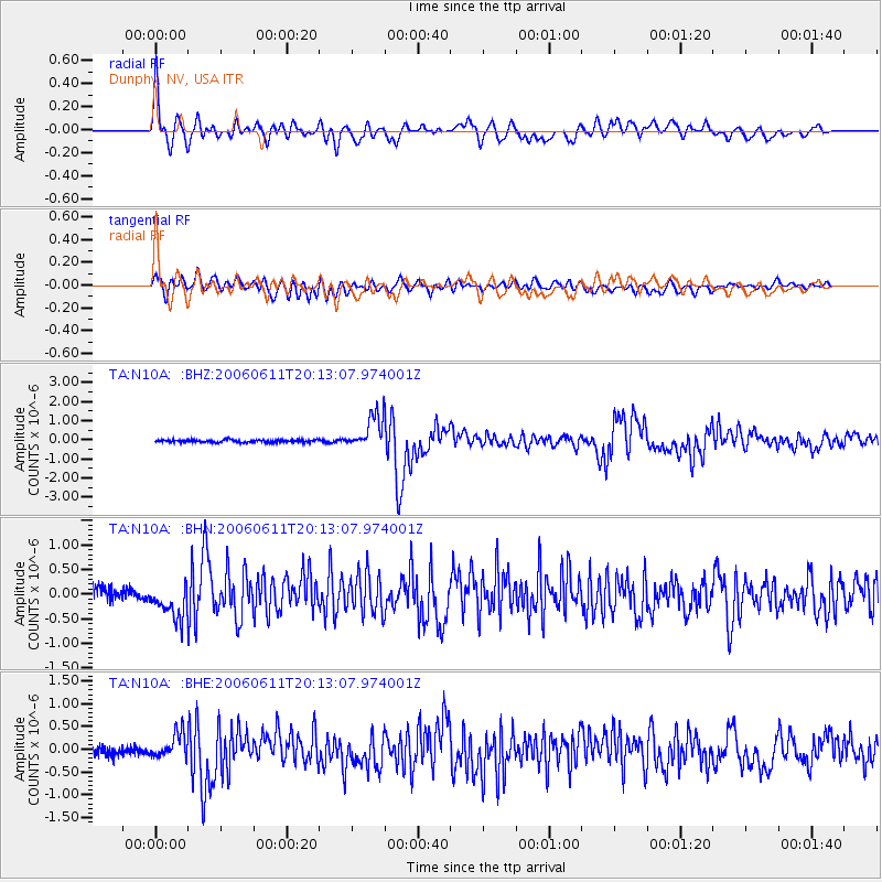
N10A Dunphy, NV, USA - Earthquake Result Viewer

| Earthquake location: |
Kyushu, Japan |
| Earthquake latitude/longitude: |
33.1/131.1 |
| Earthquake time(UTC): |
2006/06/11 (162) 20:01:26 GMT |
| Earthquake Depth: |
140 km |
| Earthquake Magnitude: |
5.9 MB, 6.3 MW, 6.3 MW |
| Earthquake Catalog/Contributor: |
WHDF/NEIC |
|
| Network: |
TA USArray Transportable Network (new EarthScope stations) |
| Station: |
N10A Dunphy, NV, USA |
| Lat/Lon: |
40.72 N/116.51 W |
| Elevation: |
1392 m |
|
| Distance: |
83.6 deg |
| Az: |
45.019 deg |
| Baz: |
308.657 deg |
| Ray Param: |
0.04573109 |
| Estimated Moho Depth: |
47.75 km |
| Estimated Crust Vp/Vs: |
1.84 |
| Assumed Crust Vp: |
6.276 km/s |
| Estimated Crust Vs: |
3.406 km/s |
| Estimated Crust Poisson's Ratio: |
0.29 |
|
| Radial Match: |
82.591385 % |
| Radial Bump: |
400 |
| Transverse Match: |
78.43743 % |
| Transverse Bump: |
400 |
| SOD ConfigId: |
5423 |
| Insert Time: |
2010-03-06 03:58:15.542 +0000 |
| GWidth: |
2.5 |
| Max Bumps: |
400 |
| Tol: |
0.001 |
|
Signal To Noise
| Channel | StoN | STA | LTA |
| TA:N10A: :BHN:20060611T20:13:07.974001Z | 2.0795422 | 3.209878E-7 | 1.5435504E-7 |
| TA:N10A: :BHE:20060611T20:13:07.974001Z | 1.7840717 | 2.6108174E-7 | 1.4634038E-7 |
| TA:N10A: :BHZ:20060611T20:13:07.974001Z | 13.804269 | 9.10777E-7 | 6.597792E-8 |
| Arrivals |
| Ps | 6.6 SECOND |
| PpPs | 21 SECOND |
| PsPs/PpSs | 28 SECOND |


