
N10A Dunphy, NV, USA - Earthquake Result Viewer
| ||||||||||||||||||
| ||||||||||||||||||
| ||||||||||||||||||
|
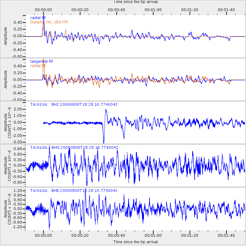
Signal To Noise
| Channel | StoN | STA | LTA |
| TA:N10A: :BHN:20060806T18:28:16.774004Z | 2.9567358 | 3.5737978E-7 | 1.208697E-7 |
| TA:N10A: :BHE:20060806T18:28:16.774004Z | 3.0462291 | 4.3111777E-7 | 1.4152506E-7 |
| TA:N10A: :BHZ:20060806T18:28:16.774004Z | 13.526726 | 1.1876589E-6 | 8.780091E-8 |
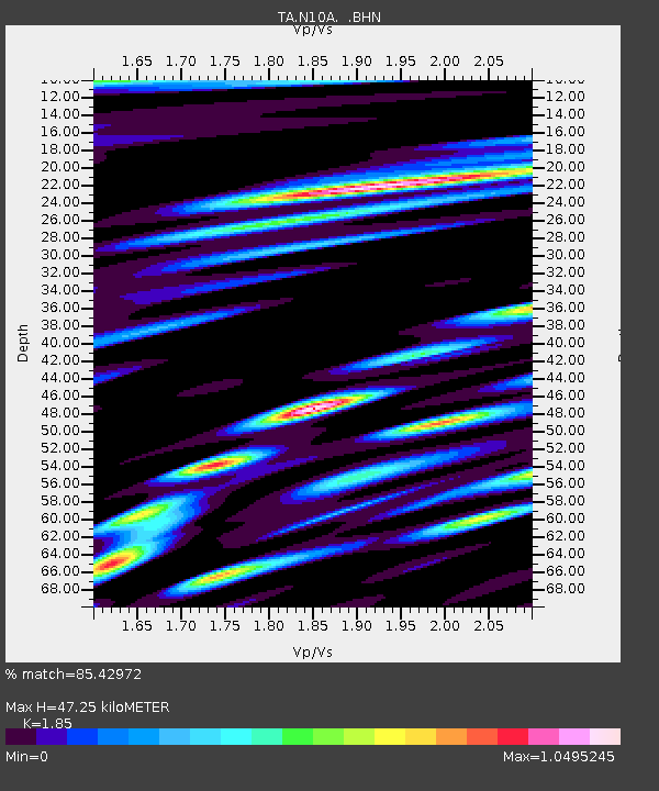
| Arrivals | |
| Ps | 6.6 SECOND |
| PpPs | 21 SECOND |
| PsPs/PpSs | 27 SECOND |

