N10A Dunphy, NV, USA - Earthquake Result Viewer
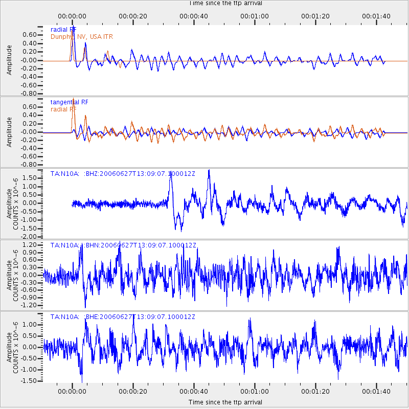
Earthquake location: Off Coast Of Chiapas, Mexico
Earthquake latitude/longitude: 15.0/-94.2
Earthquake time(UTC): 2006/06/27 (178) 13:03:12 GMT
Earthquake Depth: 29 km
Earthquake Magnitude: 5.4 MB, 5.5 MS, 5.8 MW, 5.8 MW
Earthquake Catalog/Contributor: WHDF/NEIC
Network: TA USArray Transportable Network (new EarthScope stations)
Station: N10A Dunphy, NV, USA
Lat/Lon: 40.72 N/116.51 W
Elevation: 1392 m
Distance: 32.2 deg
Az: 327.179 deg
Baz: 136.43 deg
Ray Param: 0.07871617
Estimated Moho Depth: 31.75 km
Estimated Crust Vp/Vs: 1.82
Assumed Crust Vp: 6.276 km/s
Estimated Crust Vs: 3.444 km/s
Estimated Crust Poisson's Ratio: 0.28
Radial Match: 84.175865 %
Radial Bump: 347
Transverse Match: 72.76053 %
Transverse Bump: 400
SOD ConfigId: 2665
Insert Time: 2010-03-06 03:58:44.807 +0000
GWidth: 2.5
Max Bumps: 400
Tol: 0.001

Signal To Noise

ChannelStoNSTALTA
TA:N10A: :BHN:20060627T13:09:07.100012Z3.55661065.577719E-71.5682681E-7
TA:N10A: :BHE:20060627T13:09:07.100012Z3.0329955.798502E-71.9118073E-7
TA:N10A: :BHZ:20060627T13:09:07.100012Z6.8996388.4855066E-71.229848E-7
Arrivals
Ps4.5 SECOND
PpPs13 SECOND
PsPs/PpSs18 SECOND