N10A Dunphy, NV, USA - Earthquake Result Viewer
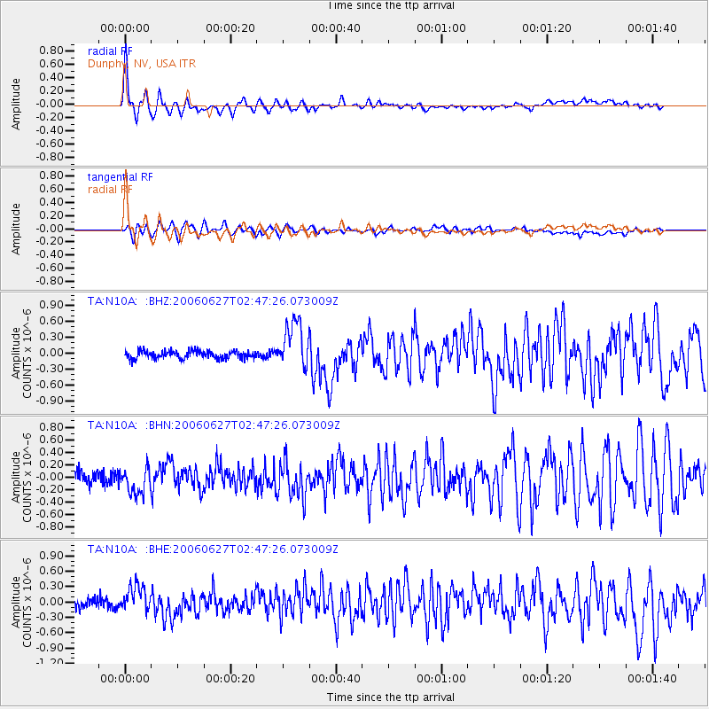
Earthquake location: Rat Islands, Aleutian Islands
Earthquake latitude/longitude: 52.2/176.2
Earthquake time(UTC): 2006/06/27 (178) 02:39:35 GMT
Earthquake Depth: 34 km
Earthquake Magnitude: 5.6 MB, 6.0 MS, 6.2 MW, 6.2 MW
Earthquake Catalog/Contributor: WHDF/NEIC
Network: TA USArray Transportable Network (new EarthScope stations)
Station: N10A Dunphy, NV, USA
Lat/Lon: 40.72 N/116.51 W
Elevation: 1392 m
Distance: 46.2 deg
Az: 76.466 deg
Baz: 308.078 deg
Ray Param: 0.070751436
Estimated Moho Depth: 27.75 km
Estimated Crust Vp/Vs: 1.84
Assumed Crust Vp: 6.276 km/s
Estimated Crust Vs: 3.406 km/s
Estimated Crust Poisson's Ratio: 0.29
Radial Match: 88.32898 %
Radial Bump: 395
Transverse Match: 72.02062 %
Transverse Bump: 400
SOD ConfigId: 2665
Insert Time: 2010-03-06 03:58:47.532 +0000
GWidth: 2.5
Max Bumps: 400
Tol: 0.001

Signal To Noise

ChannelStoNSTALTA
TA:N10A: :BHN:20060627T02:47:26.073009Z2.0619652.0722568E-71.0049913E-7
TA:N10A: :BHE:20060627T02:47:26.073009Z2.66926742.5474725E-79.5437144E-8
TA:N10A: :BHZ:20060627T02:47:26.073009Z6.22664264.5093574E-77.242036E-8
Arrivals
Ps3.9 SECOND
PpPs12 SECOND
PsPs/PpSs16 SECOND