
I05A Bend, OR, USA - Earthquake Result Viewer
| ||||||||||||||||||
| ||||||||||||||||||
| ||||||||||||||||||
|
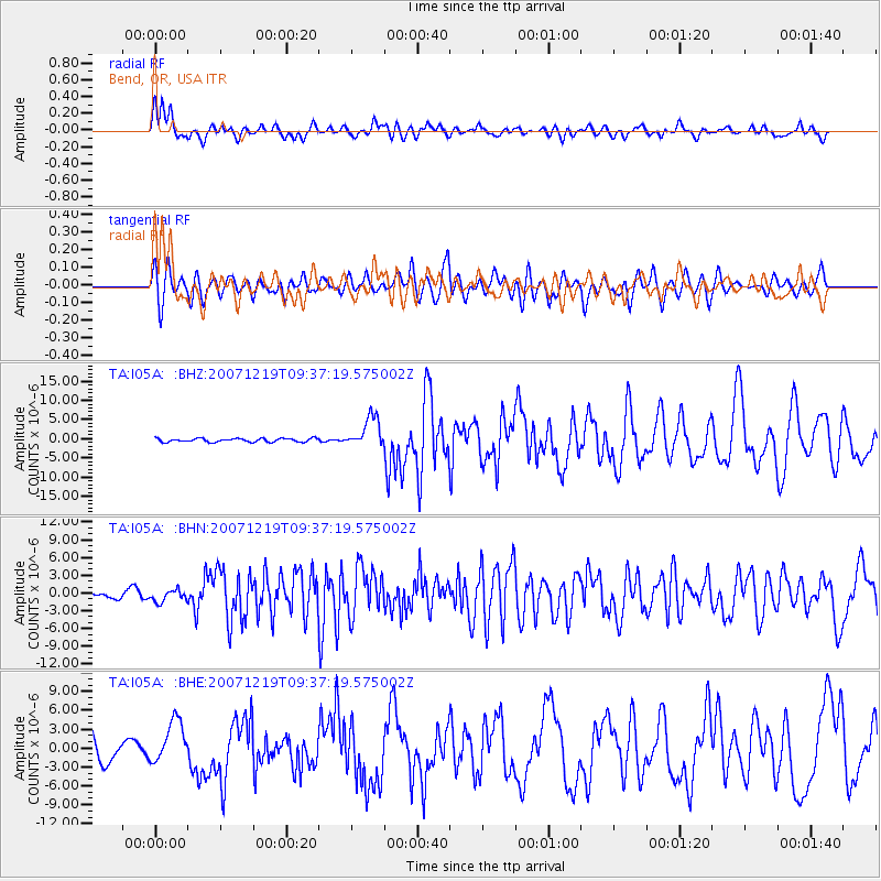
Signal To Noise
| Channel | StoN | STA | LTA |
| TA:I05A: :BHN:20071219T09:37:19.575002Z | 0.75578356 | 9.850635E-7 | 1.3033672E-6 |
| TA:I05A: :BHE:20071219T09:37:19.575002Z | 1.9463098 | 3.3866963E-6 | 1.7400603E-6 |
| TA:I05A: :BHZ:20071219T09:37:19.575002Z | 8.761779 | 4.001701E-6 | 4.5672246E-7 |
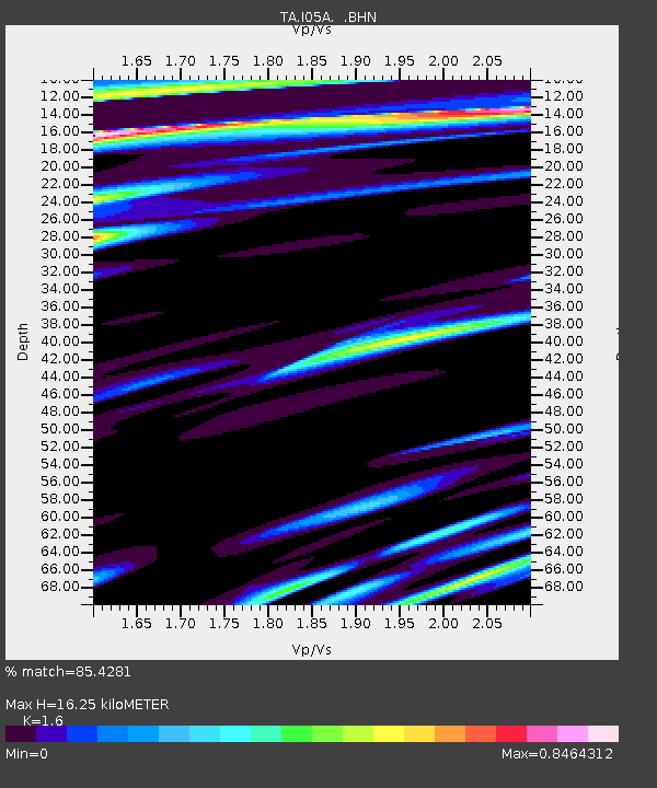
| Arrivals | |
| Ps | 1.6 SECOND |
| PpPs | 5.9 SECOND |
| PsPs/PpSs | 7.5 SECOND |

