You are here: Home > Network List > LD - Lamont-Doherty Cooperative Seismographic Network Stations List
> Station GEDE Greenville, DE, USA > Earthquake Result Viewer
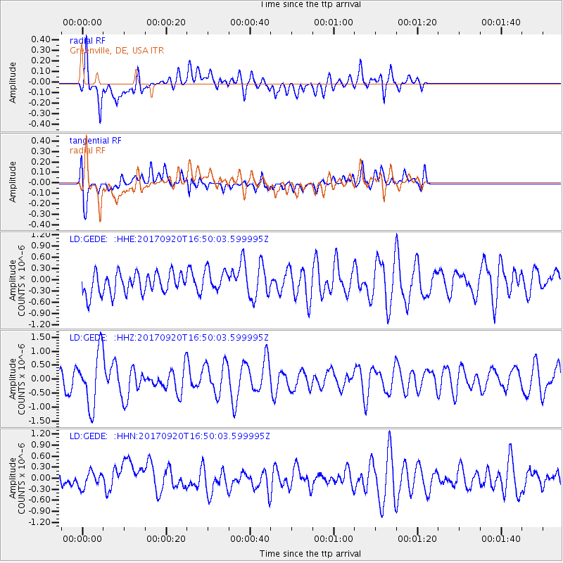
GEDE Greenville, DE, USA - Earthquake Result Viewer
*The percent match for this event was below the threshold and hence no stack was calculated.
| Earthquake location: |
Off East Coast Of Honshu, Japan |
| Earthquake latitude/longitude: |
38.0/144.7 |
| Earthquake time(UTC): |
2017/09/20 (263) 16:37:16 GMT |
| Earthquake Depth: |
10 km |
| Earthquake Magnitude: |
6.1 Mww |
| Earthquake Catalog/Contributor: |
NEIC PDE/us |
|
| Network: |
LD Lamont-Doherty Cooperative Seismographic Network |
| Station: |
GEDE Greenville, DE, USA |
| Lat/Lon: |
39.81 N/75.64 W |
| Elevation: |
105 m |
|
| Distance: |
94.2 deg |
| Az: |
29.973 deg |
| Baz: |
329.167 deg |
| Ray Param: |
$rayparam |
*The percent match for this event was below the threshold and hence was not used in the summary stack. |
|
| Radial Match: |
54.689957 % |
| Radial Bump: |
400 |
| Transverse Match: |
55.48147 % |
| Transverse Bump: |
400 |
| SOD ConfigId: |
13570011 |
| Insert Time: |
2019-04-28 20:12:29.134 +0000 |
| GWidth: |
2.5 |
| Max Bumps: |
400 |
| Tol: |
0.001 |
|
Signal To Noise
| Channel | StoN | STA | LTA |
| LD:GEDE: :HHZ:20170920T16:50:03.599995Z | 2.5233886 | 9.931898E-7 | 3.9359367E-7 |
| LD:GEDE: :HHN:20170920T16:50:03.599995Z | 0.6314477 | 2.1309799E-7 | 3.374753E-7 |
| LD:GEDE: :HHE:20170920T16:50:03.599995Z | 1.0863813 | 2.9918033E-7 | 2.7539164E-7 |
| Arrivals |
| Ps | |
| PpPs | |
| PsPs/PpSs | |


