You are here: Home > Network List > TA - USArray Transportable Network (new EarthScope stations) Stations List
> Station O04C Chester, CA, USA > Earthquake Result Viewer
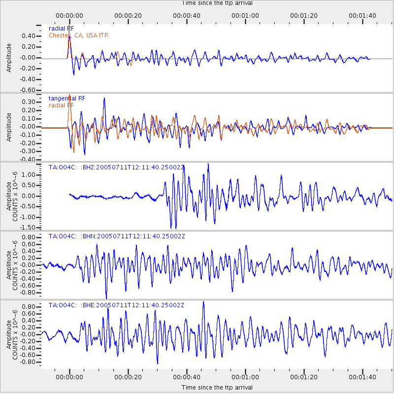
O04C Chester, CA, USA - Earthquake Result Viewer

| Earthquake location: |
Easter Island Region |
| Earthquake latitude/longitude: |
-23.8/-111.7 |
| Earthquake time(UTC): |
2005/07/11 (192) 12:01:35 GMT |
| Earthquake Depth: |
10 km |
| Earthquake Magnitude: |
6.0 MB, 5.4 MS, 5.8 MW, 5.8 MW |
| Earthquake Catalog/Contributor: |
WHDF/NEIC |
|
| Network: |
TA USArray Transportable Network (new EarthScope stations) |
| Station: |
O04C Chester, CA, USA |
| Lat/Lon: |
40.32 N/121.09 W |
| Elevation: |
1513 m |
|
| Distance: |
64.4 deg |
| Az: |
352.036 deg |
| Baz: |
170.447 deg |
| Ray Param: |
0.05894241 |
| Estimated Moho Depth: |
65.5 km |
| Estimated Crust Vp/Vs: |
2.10 |
| Assumed Crust Vp: |
6.566 km/s |
| Estimated Crust Vs: |
3.13 km/s |
| Estimated Crust Poisson's Ratio: |
0.35 |
|
| Radial Match: |
86.61695 % |
| Radial Bump: |
400 |
| Transverse Match: |
84.15607 % |
| Transverse Bump: |
400 |
| SOD ConfigId: |
2475 |
| Insert Time: |
2010-03-06 04:01:36.219 +0000 |
| GWidth: |
2.5 |
| Max Bumps: |
400 |
| Tol: |
0.001 |
|
Signal To Noise
| Channel | StoN | STA | LTA |
| TA:O04C: :BHN:20050711T12:11:40.25002Z | 2.2541065 | 1.5622686E-7 | 6.930767E-8 |
| TA:O04C: :BHE:20050711T12:11:40.25002Z | 2.215055 | 1.5120114E-7 | 6.826067E-8 |
| TA:O04C: :BHZ:20050711T12:11:40.25002Z | 7.8899317 | 4.746537E-7 | 6.0159415E-8 |
| Arrivals |
| Ps | 11 SECOND |
| PpPs | 30 SECOND |
| PsPs/PpSs | 41 SECOND |


