O04C Chester, CA, USA - Earthquake Result Viewer
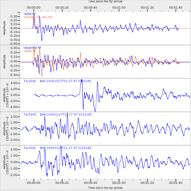
Earthquake location: New Britain Region, P.N.G.
Earthquake latitude/longitude: -5.9/151.0
Earthquake time(UTC): 2006/10/17 (290) 01:25:12 GMT
Earthquake Depth: 32 km
Earthquake Magnitude: 6.4 MB, 6.9 MS, 6.7 MW, 6.6 MW
Earthquake Catalog/Contributor: WHDF/NEIC
Network: TA USArray Transportable Network (new EarthScope stations)
Station: O04C Chester, CA, USA
Lat/Lon: 40.32 N/121.09 W
Elevation: 1513 m
Distance: 92.2 deg
Az: 49.875 deg
Baz: 264.201 deg
Ray Param: 0.041488245
Estimated Moho Depth: 44.0 km
Estimated Crust Vp/Vs: 1.61
Assumed Crust Vp: 6.566 km/s
Estimated Crust Vs: 4.085 km/s
Estimated Crust Poisson's Ratio: 0.18
Radial Match: 91.632484 %
Radial Bump: 400
Transverse Match: 87.99936 %
Transverse Bump: 400
SOD ConfigId: 2665
Insert Time: 2010-03-06 04:02:38.528 +0000
GWidth: 2.5
Max Bumps: 400
Tol: 0.001

Signal To Noise

ChannelStoNSTALTA
TA:O04C: :BHN:20061017T01:37:47.323018Z1.53839362.8011638E-71.8208368E-7
TA:O04C: :BHE:20061017T01:37:47.323018Z3.12663087.4560626E-72.3846957E-7
TA:O04C: :BHZ:20061017T01:37:47.323018Z14.550752.3995303E-61.6490768E-7
Arrivals
Ps4.2 SECOND
PpPs17 SECOND
PsPs/PpSs21 SECOND